This July, while I was preparing for the Longest Commute, I made my usual pre-trip browse of the audiobooks available on Audible that I might be interested in listening to during the long hours in the car. On this particular trip I had even more driving time than usual to listen to books, podcasts, and music as I made my way through the varied scenery of the Midwest, South, and Northeast. I already had a biography of the German naturalist Alexander von Humboldt on my listening list, and there were other books I’d downloaded for previous long drives that I had yet to touch such as a memoir by actor Cary Elwes about his time making The Princess Bride. But I wanted something that related to the trip itself, something to get me even more excited about the things I’d be seeing along the way.
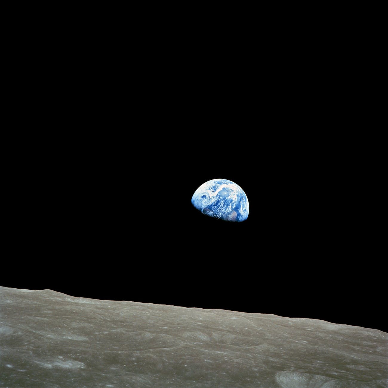
I settled on an Audible original called The Space Race which tells the history of NASA and Roscosmos from the launch of Sputnik 1 in 1957 up into our current generation of public and private spaceflight agencies and companies competing and cooperating in our continued reach for the stars. The whole story was narrated by Kate Mulgrew, an actress I know best from her role as Captain Kathryn Janeway on Star Trek: Voyager and seeing her name on the billing was among the reasons why I chose this particular thing to listen to. I won’t call it a book, it was more of a series of radio shows with a combination of narration, talking heads, and scenes set in the next century.
Those scenes, the ones set in the future are the ones I want to talk to you about today. They posit that the only way humans can ever hope to reach a habitable planet orbiting our closest neighboring star, Alpha Centauri, would be by a generational ship, one where the original passengers’ grandchildren would be the ones to set foot on that planet, and would only be possible through genetic engineering to ensure that those humans who made it there would be well suited to the environment they found and would soon call home, after all any trip that takes three generations to complete would have no path of return.
I for one am eager to see humanity reach beyond Earth and our Moon towards Mars and beyond. We have the potential to do really tremendous things, to learn so much from those experiences about our universe and about ourselves. Why else would TV series and films like the ones from Star Trek be so intriguing to me? They offer us a vision of a future where our introduction to our cosmic neighborhood makes us better people and ushers in a veritable golden age here on Earth. Why would that not be a thrilling prospect?
I listened to the last few scenes of The Space Race while I was driving east along I-10 in the Florida Panhandle, and the moment when they acknowledged that in the world of their story that genetic engineering would be necessary for such a voyage, I felt chills. So, let me ask you this question: if the purpose of exploration at any scale is both extroverted and by equal measures introspective, if the curiosity at the heart of any exploration is a part of what makes us human, then to what lengths should we go to satisfy that curiosity? Should we go as far as to transform our very genetic code, the most essential biological parts of who we are?
This is a question I really worry about. I’m as much an everyday explorer as anyone else, yet there are limits for me as to how far I’m willing to go to satisfy my curiosity; I don’t know that I would want to push myself to such a point that I’d be willing to change who I am just to see over the next horizon. We are who we are because of so many complex and intricate pieces to our identities. Untangle any of those threads and are we still the same person? It makes logical sense that future explorers would consider adapting themselves to the environment of the planet they’re seeking to visit, yet among the things that make us human are our roots to this our home planet. What would the humans who first set foot on that alien world be like if they have no memory of their own world?
If we are to engineer ourselves in any way to adapt to life as a spacefaring or interplanetary species, then let it be technological rather than biological engineering. Let’s create the habitats we would need to survive on Mars so that we can travel to other worlds as ourselves and not as some engineered offshoot of humanity growing ever distant from the source. Let’s take with us our collective memory of all our triumphs and our faults. Let’s bring our stories & music, our proclivities & our imperfections with us for they are what make us human.
And if our explorers should meet anyone out there who is just as curious about the unknown as we are then let them meet us as we are. Let them see us for who we are. Let them see both our problems and our possibilities.
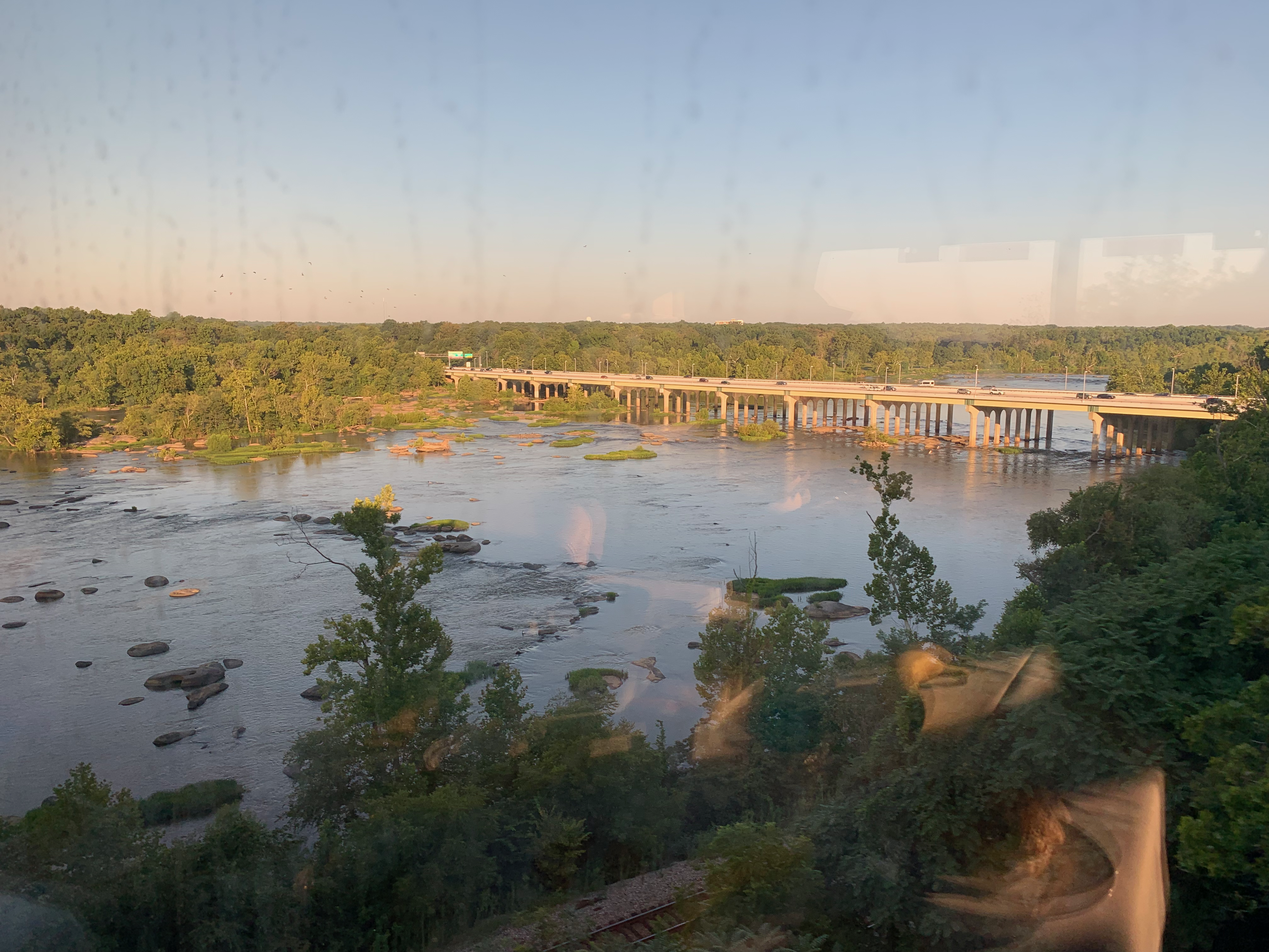
I had a restless night on board the Auto Train, from the flashing lights to my right as the curtains in my roomette with the rocking of the train, to the audible voices in the corridor beyond, to the frequent bumps and lurches on the rails. Still, after about 7 hours I decided to get up, shower, and get dressed for the day ahead. I had breakfast in the dining car as we crossed the James River and rolled through Richmond, Virginia. That capital city was radiant in the morning sun.
Crossing the James River.
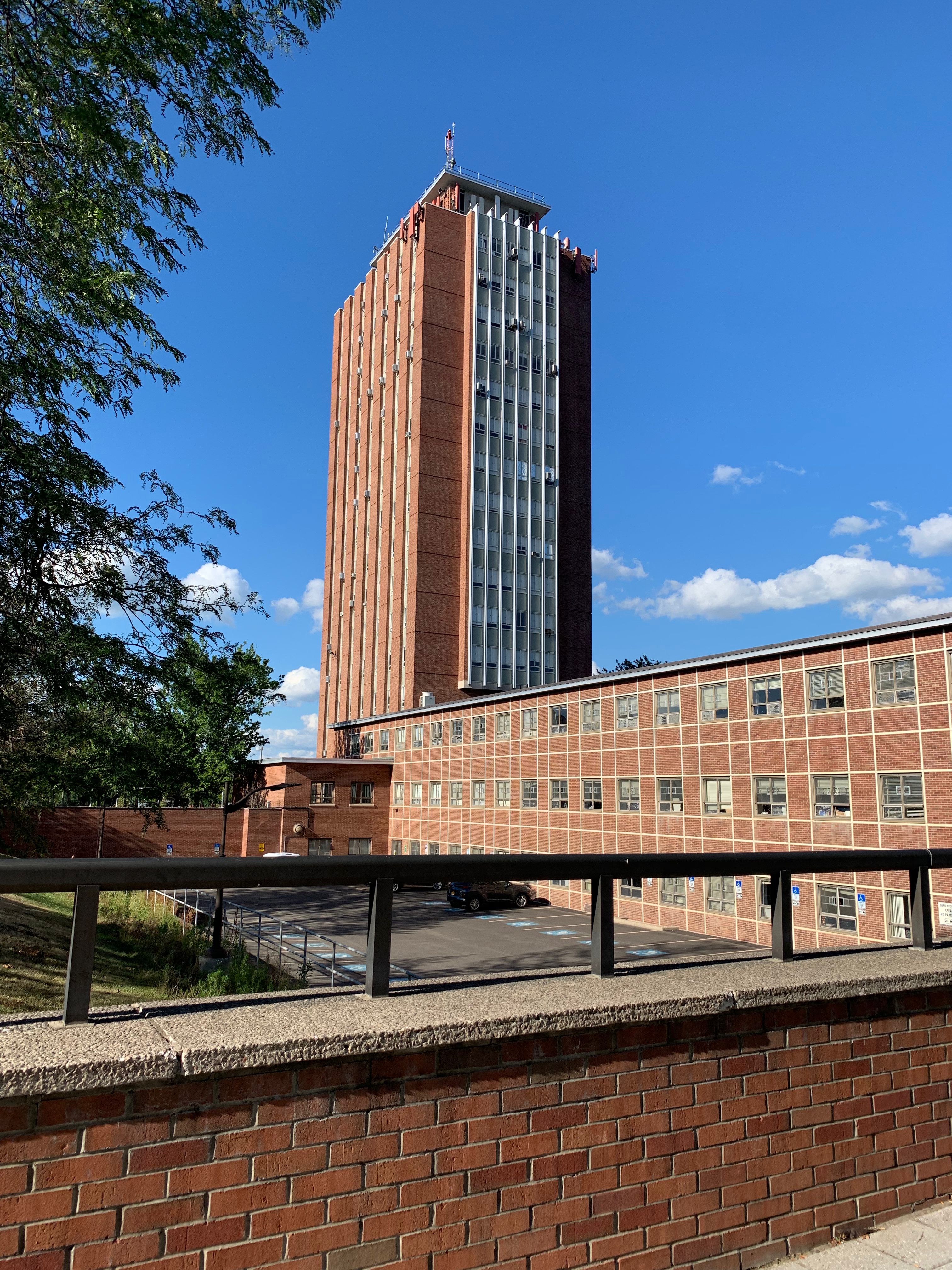
At 9:30, a good half-hour ahead of schedule, we pulled into the northern terminus of the Auto Train in Lorton, Virginia, a suburb of Washington, DC nestled in the hills near the Potomac. I stepped down onto the platform soon after, collected my car, and drove into the Virginia morning bound for my main stop of the day. Virginia is one of the two oldest English colonies in North America, founded in 1607 with the establishment of Jamestown. The Puritans of New England, better known as the Pilgrim Fathers, didn’t arrive until 13 years later in 1620. Whereas the Puritans established a theocracy in the North, here in the South the Virginians established a plantation society focused on wealth and farming.
The plantations of Virginia inspired the culture and social order of the rest of the South down into the present. In some ways, these plantations are akin to the ranches of the Southwest and haciendas of the old Spanish colonies because they are all focused on the same overarching thing: using the land for its profits.
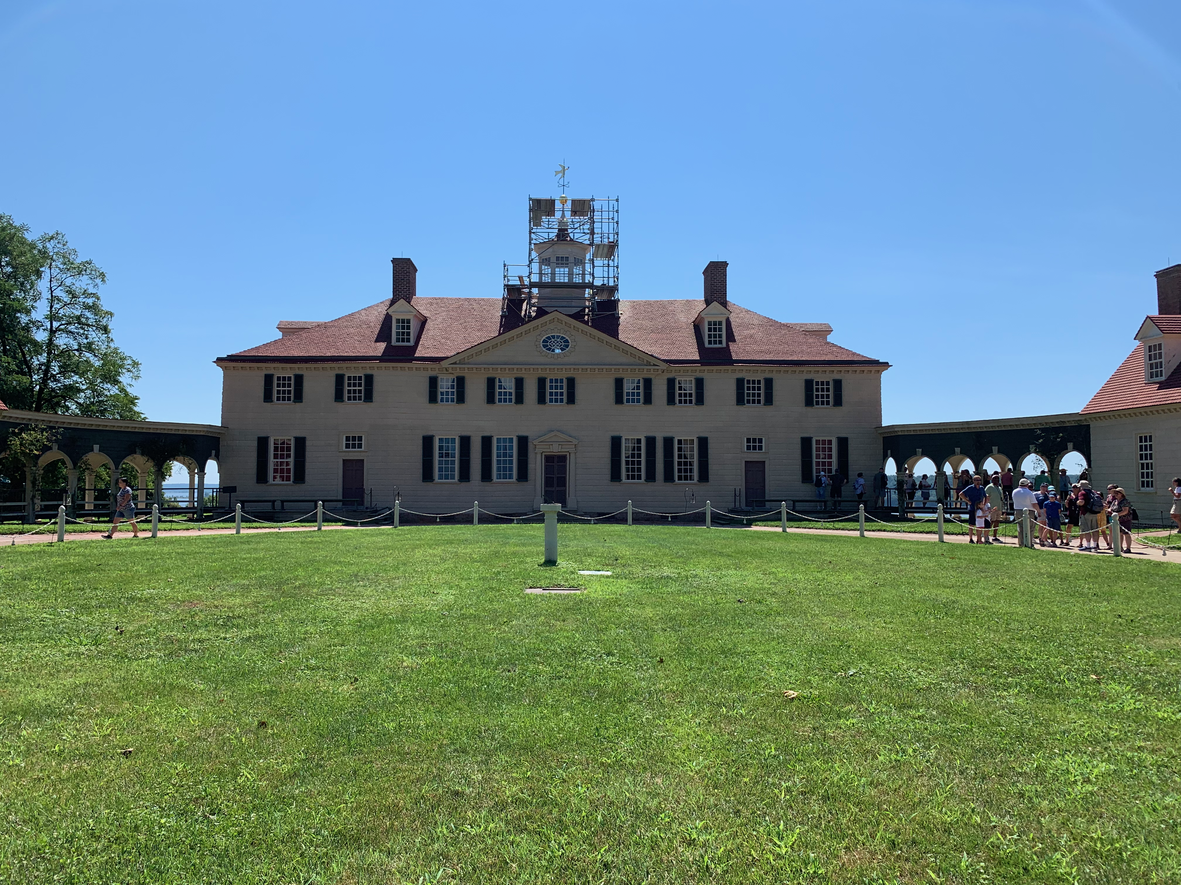
It was one such plantation that I was driving towards that morning as I passed Fort Belvoir, Mount Vernon, the home of the first President of the United States: George Washington. I’ve spent a lot of time in DC compared to the rest of the East Coast, but in all those trips I’ve never made it out to Mount Vernon, largely because I haven’t had a car on most of those trips to make the journey, or because I just couldn’t fit it into a busy schedule. So, upon seeing how close the Auto Train station in Lorton is to Mount Vernon I knew I had to fit a stop in.
Mount Vernon.
Mount Vernon sits on high ground overlooking a bend in the Potomac about 15 miles downriver from Washington, DC. The mansion house itself was first built by Washington’s father Augustine Washington in 1734 on land that the Washington family had owned since 1674. George Washington began inheriting parts of the estate in 1754 before becoming its sole owner in 1761. The image of himself that he most wanted to be remembered by, that of Farmer George, is best realized there at Mount Vernon, which has been carefully and diligently restored to its appearance in 1799, the year of Washington’s death, by its current owners the Mount Vernon Ladies’ Association.
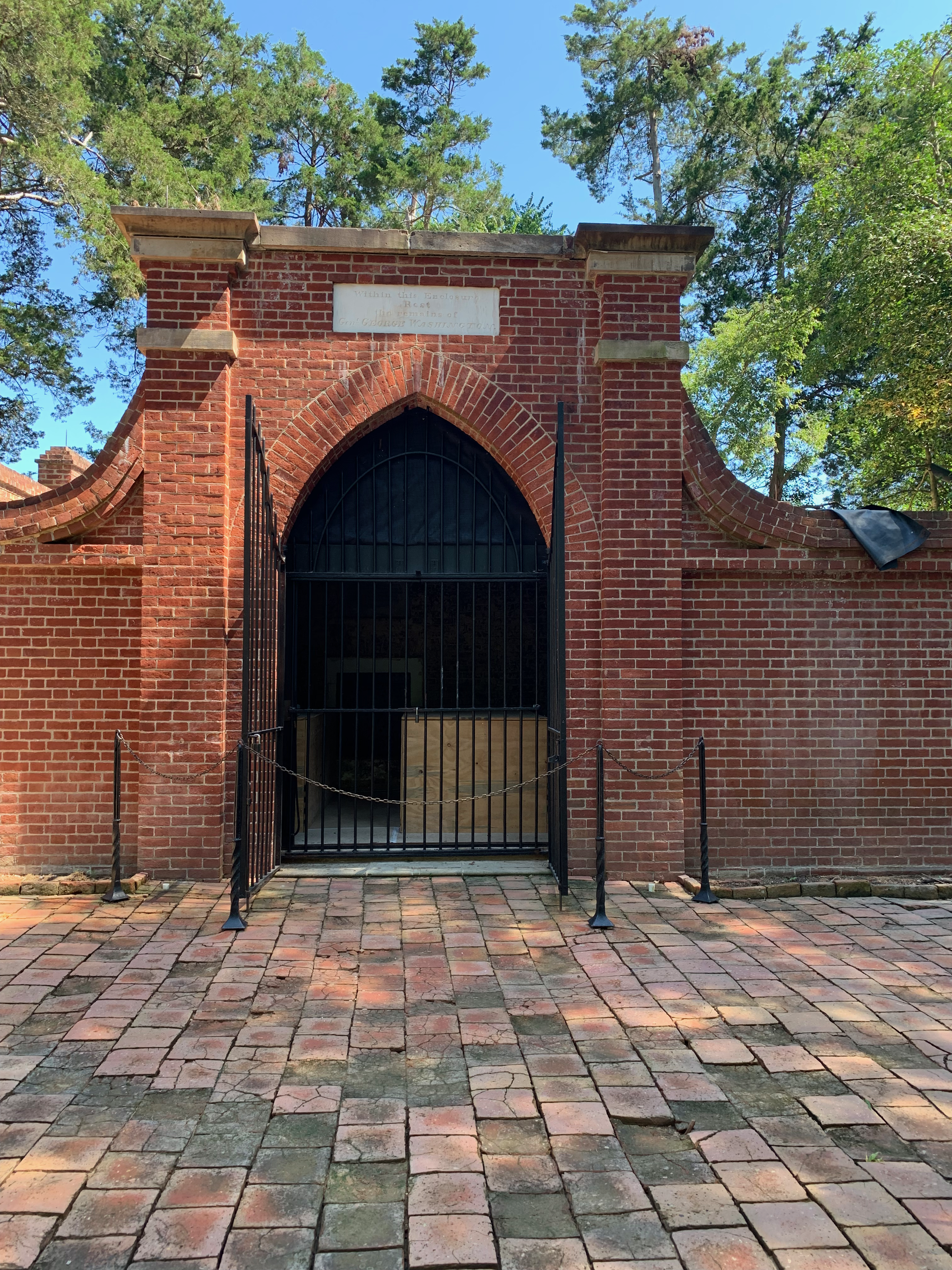
Washington’s Tomb.
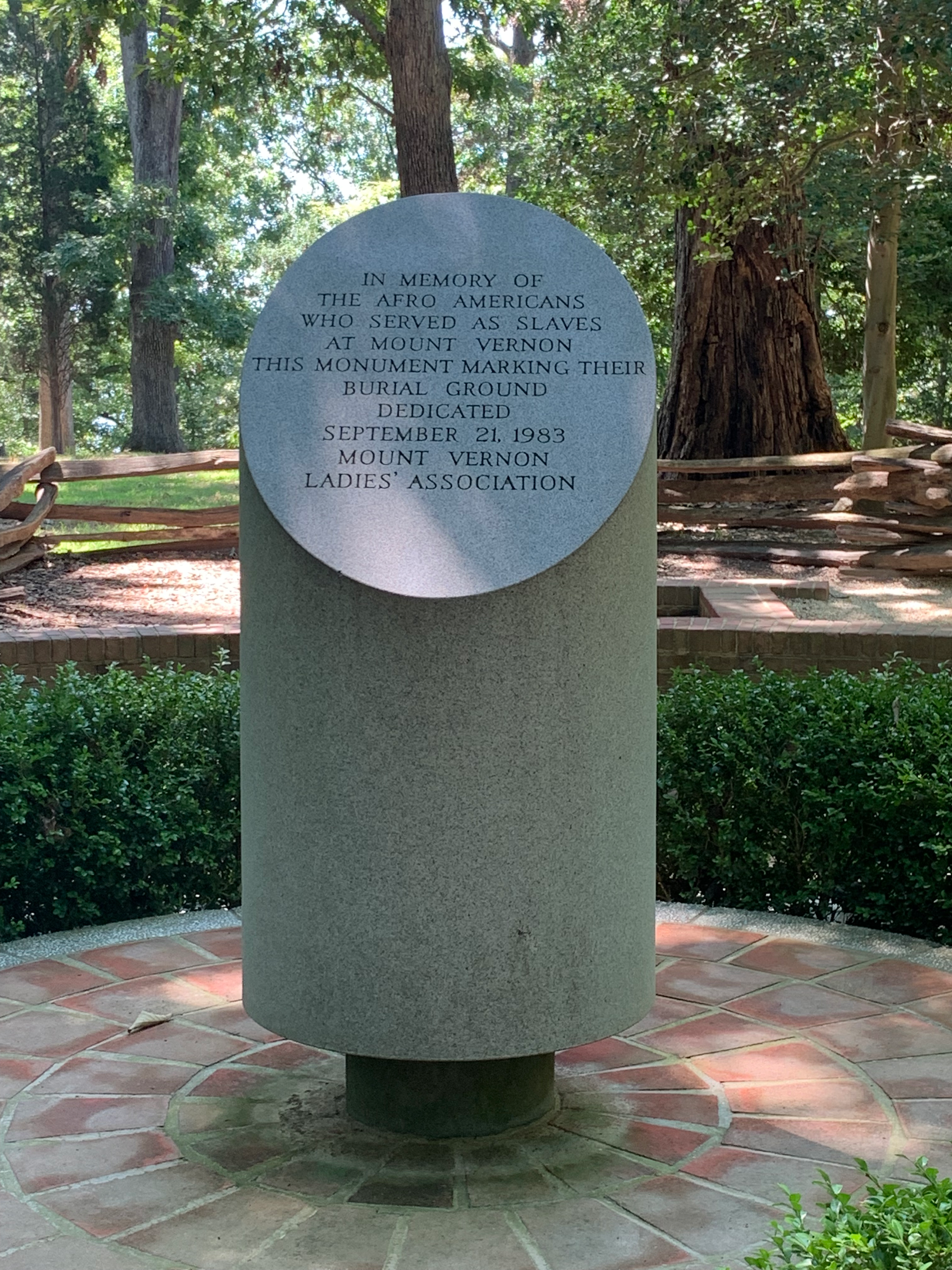
Arriving on the grounds I first made my way towards Washington’s tomb, wanting to see as much of the outdoor things to see there in the morning before the afternoon heat index well over 100ºF set in. At one point there was talk of burying Washington in the crypt beneath the rotunda of the US Capitol building, yet ever the one to avoid grandiosities Washington instead insisted on being buried in a new vault on Mount Vernon, the place he loved more than any other. His tomb is fittingly simple, a vault with an iron gate in which he and his closest family are buried. Outside of it are two obelisks which mark the graves of other Washington relatives who died in the 19th century. A short walk from Washington’s grave is another memorial marker, this one honoring the enslaved African Americans who worked on Mount Vernon. Both were somber sights to behold, the former a tomb of a man who did so much in his day to establish the precedents of our government still in place, the latter a marker of horrendous evils inflicted by that same man upon those who he relied on.
One of the great highlights for me was that afternoon when I took a guided tour of the Mount Vernon mansion, a Palladian structure that has been often used as a model for many later neo-colonial buildings to the point that the layout and interiors seemed almost familiar to me. In some respects, it reminded me of the big farmhouse that I grew up in from the front hall to the social rooms on the ground floor, which in my old house were largely all one big room, to the formal dining room off to the side. On the upper level the idea of having guest bedrooms is something that was very real to me, as we had more sleeping space for guests in that farmhouse than we had for ourselves, though there was only 1 guest bedroom in the place. On the upper level I saw the room where Washington died, restored according to a painting from the 1830s that used eyewitness testimony to be accurate to how the room had looked 30 years before.
After the deaths of George and Martha Washington and their immediate relatives Mount Vernon fell into disrepair, owing in part to changes in the plantation economy and soil exhaustion in those well-settled parts of Virginia. I was touched to learn how the estate was honored and protected by both sides during the Civil War, being one of maybe only a handful of places considered neutral. This saved and preserved Mount Vernon from meeting the same fate as many of its peers throughout the South which were often burnt and ransacked by the passing armies.
I left Mount Vernon after a good 6 hour visit and made my way northwest across northern Virginia to my hotel for the night near Dulles Airport. In general, when it comes to a bigger city like DC, if I have my car with me, I usually prefer to find hotels that are outside of the center but close to a train or metro line so that I can leave my car in a park-and-ride for the day and go into town, while not having to pay downtown hotel or parking rates. I had some ideas of going into DC on this trip, perhaps to visit the National Zoo, but ended up choosing not to, instead staying out near Dulles both that evening due to exhaustion from travel and the poor sleep the night before, and out of an eye for budgetary frugality.
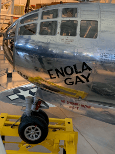
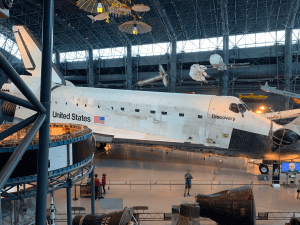
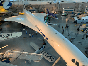
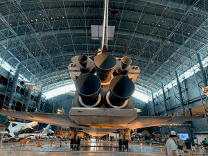
The following day I did make one tourist stop at the National Air and Space Museum’s Udvar-Hazy Center, a massive hangar near Dulles that houses the Smithsonian’s impressive aircraft and spacecraft collection. There’s an old Air France Concorde in there, as well as the Enola Gay, the B-29 that dropped the atomic bomb on Hiroshima on 6 August 1945. The Space Shuttle Discovery is also housed there, in its own wing of the hangar surrounded by other spacecraft, including John Glenn’s Friendship 7, and a collection of German, American, and Soviet rockets. They even have Chuck Yeager’s Glamorus Glennis, a Bell X-1 in which Yeager became the first human to break the sound barrier in 1947, traveling at Mach 1. I wandered around these feats of human ingenuity and engineering so excited to see each and every one of them. But I knew I needed to be moving again, back on the road north, hopefully to make good time in reaching that night’s hotel.
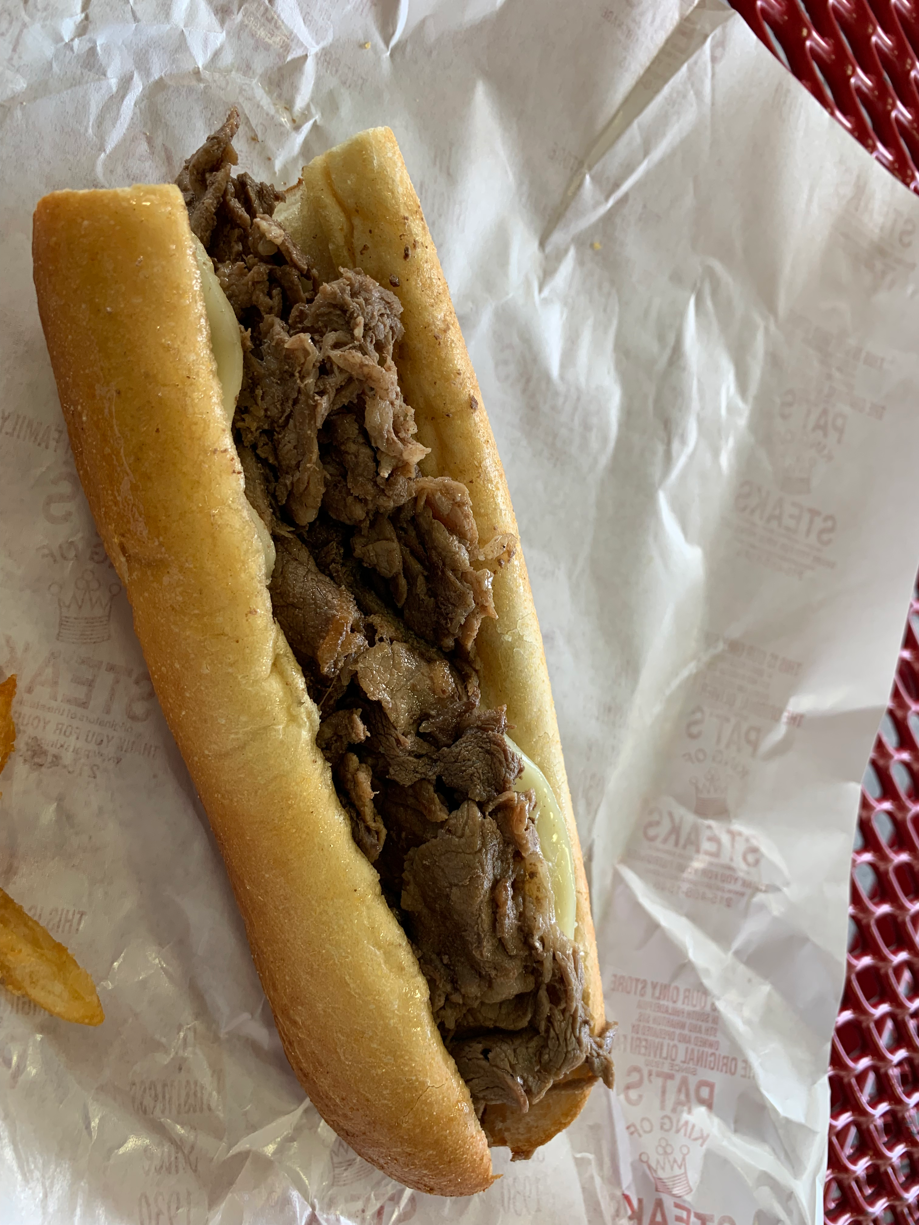
I left Dulles at around 13:30 that afternoon, driving around the western and northern sides of the Capital Beltway to I-95 and aiming my car northeast along that great artery of the Interstate system that parallels the Atlantic coast from Miami to Maine. Today though I would only be passing through four states, Virginia, Maryland, Delaware, and Pennsylvania. As I was driving through Baltimore, taking the Fort McHenry Tunnel under Baltimore Harbor, I decided to adjust my route a bit and not go straight to my hotel in suburban Philly but instead to make a stop at Pat’s the King of Steaks in South Philadelphia because “it’s on the way.” I made it to Pat’s just after 5 pm, as the glow of the evening sun seemed to be like twilight as it shone between the old brick buildings around the intersection of S. 9th St, Wharton St, and E. Passyunk Ave.
Provelone without
The last time I was in Philadelphia in October 2019 I made my first visit to Pat’s after it was suggested to me as the best option for a cheesesteak by the park rangers at Independence Hall. I found it to be as good as I was told, a wonderful steak sandwich that was one of the easiest meals I’d yet found to order. In my case, I get the “Provolone without,” that is a provolone cheesesteak without onions. On this visit I was happy to be able to have Pat’s again after the pandemic kept me from traveling throughout the East for much of 2020 and 2021. These sorts of steak sandwiches, invented by working class immigrants and their children in the big old cities like Chicago and Philly are a real wonder for American cuisine. I’d compare the influence of the cheesesteak to that of the Italian Beef, a Chicago invention that is more slowly expanding in reach beyond that lakeside metropolis to be known and loved throughout the US.
While waiting at a traffic light near the old docks on Columbus Boulevard, I looked off towards the banks of the Delaware River at the great wharf buildings that were once the beating heart of that city’s international trade. It was through one such building that my 2nd great-grandfather Edward Maher arrived in this country in 1878, receiving an honorable discharge from the British Merchant Navy in which he had served for several years. Though I don’t know which wharf or which dock was the one that witnessed his arrival in America, I felt that the sorry pair I spied that evening in their faded grandeur could well serve as proxies for the spot where that one of my own ancestors first set foot on these shores.
The idea to stop at Pat’s on the way into Philly was good from a geographic perspective, but as soon as I’d left Pat’s and made my way back onto I-95, I quickly found that from a time and traffic perspective that it wasn’t my finest moment. I crawled through Philly that evening, making it to my overnight hotel after an hour of bumper-to-bumper traffic. By then I was just as exhausted as the night before, and not in the mood to try or do anything fancy. So, I sat down on the sofa in my hotel room, turned the TV to WHYY (Philadelphia’s PBS station) and spent the evening watching Nature and NOVA, two of my favorite shows on the air.
The next morning, I woke early, and quickly packed up my things, checking out of the hotel by 8:45. I made it to the 9:10 train at the Norristown Transportation Center with a good 15 minutes to spare, enough time to buy a new Key Card, the local transit smart card issued by SEPTA (the Southeastern Pennsylvania Transportation Authority) and boarded the regional service bound for the Center City. The plan that day was pretty simple: I wanted to visit the Academy of Natural Sciences, my favorite stop on my last trip to Philly in 2019, and then get back out to my car in Norristown to begin the last leg of the trip with a drive up to Binghamton. As luck would have it, nothing went wrong with the trip that day. I made it into Philly by 10:00 am, and walked from Suburban Station to the Academy in good time, arriving about 5 minutes after they opened their doors for the day.
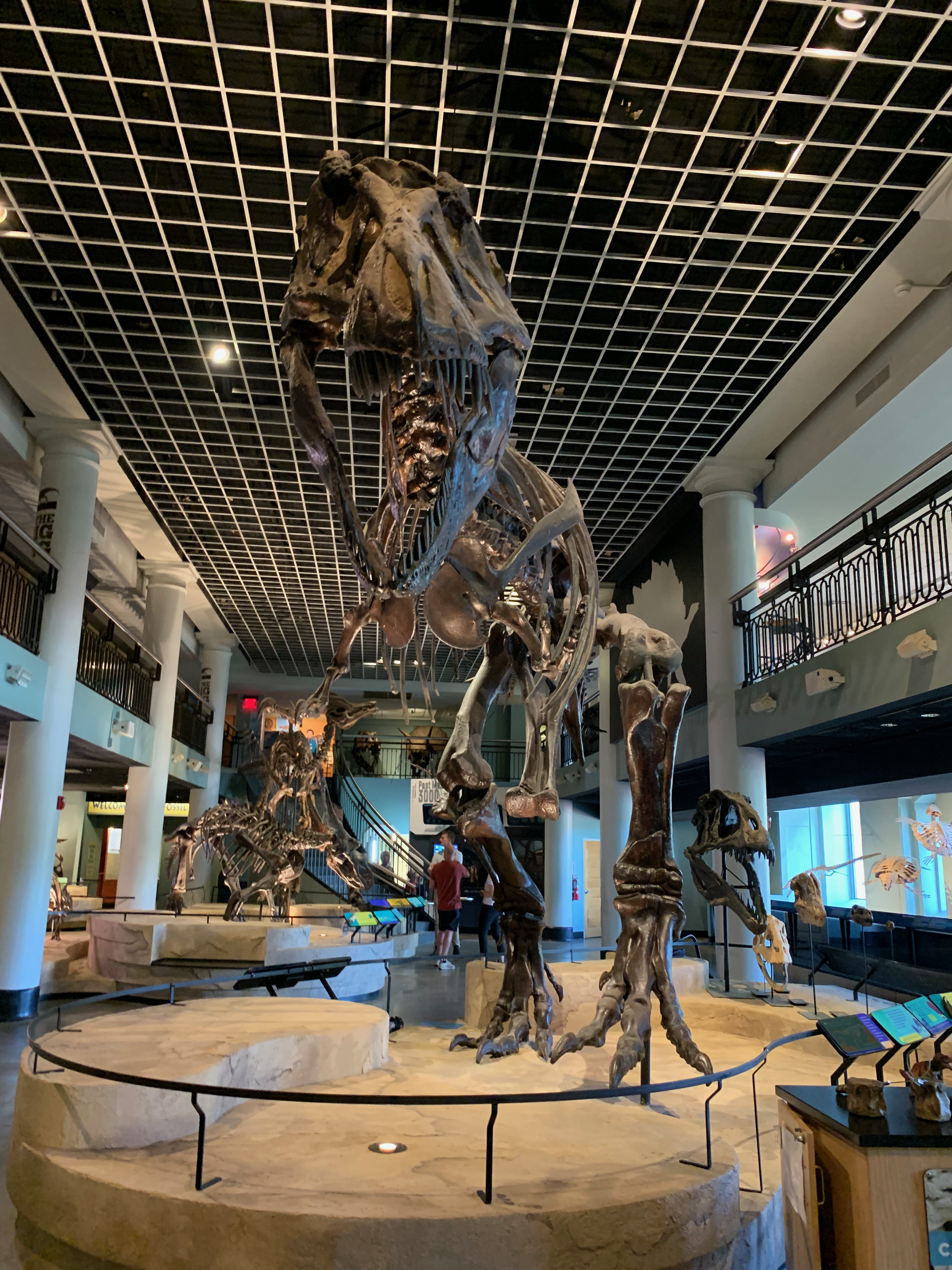
The Dinosaur Hall.
The Academy of Natural Sciences is, in my humble opinion, the best natural history museum in the East. When it comes to natural history museums, I’m especially fond of the dioramas, the displays of taxidermied animals on naturalistic backdrops, of which the Academy has plenty spread out across 3 floors. Their dinosaur collection is smaller than either the American Museum in New York or the Smithsonian’s in Washington, but when it comes to dioramas Philly has them both beat in how they’re laid out and how intimate they seem. This is especially true compared to the ones in New York where the rooms are so dark that it almost feels hard to really get an appreciation for the animals on display. My two favorite natural history museums in the US are my “home museum” the Field Museum in Chicago, and the Denver Museum of Nature and Science, both of which ought to be the poster children, or better yet the type species of American natural history museums in how they set the standard that other museums ought, in again my humble opinion, to follow.
While I was at the Academy, I noticed there was a film crew in the dinosaur hall. I looked to see who was on camera and was surprised to find it was British documentary filmmaker Dan Snow. My general rule when running into famous people is to treat them like anyone else, give them their space, and don’t disrupt what they’re doing. How would you feel if you were working, and some random guy walked up to you and started chatting? I later had a very short but pleasant exchange with him on Twitter about seeing him there. Nice guy.
I wandered around the halls of the Academy of Natural Sciences for a good two hours, just soaking all of it in. When I first agreed to come to Binghamton for my PhD, one of the big things I agreed to myself was that I’d take advantage of being so close to so many wonderful cities with astounding museums to visit as many of them as I could. Because of the pandemic I haven’t been able to be as thorough at that promise as I would’ve wanted, but I’m confident in the future as I find my way into better jobs that I’ll be able to afford the odd weekend trip to see places such as this.
From the Academy I went down into the subway under Market Street and took the trolley to 30th Street, exiting at Philadelphia’s grand Amtrak terminal, where I had a quick lunch of a chicken teriyaki bento box and looked into how to get back to my car in Norristown. I could either wait an hour and catch the same train I took that morning back out to the suburbs, or I could take a timelier route on Philly’s L and interurban services and get there far sooner. Naturally then, I chose the latter, returning to the subway to catch the L to 69th Street, where I transferred to the Norristown High Speed Line, a 13.4 mile (21.6 km) interurban that runs by, among other things, Villanova University. So, at 12:40 I found myself back in my car in the Norristown Transportation Center’s garage, quickly writing out some postcards and setting my navigation system to take me north to my final stop on this Longest Commute, my place of work itself, Binghamton, New York.
The last leg of the trip was the shortest, a mere 2.5 hours between Norristown and Binghamton along the Northeast Extension of the Pennsylvania Turnpike (Interstate 476) to the northern edge of the Wyoming Valley just outside of Scranton and then a quick jump up Interstate 81 and across the New York border to the Susquehanna valley and Binghamton. I finally arrived at my apartment at 4:30 pm on Thursday, 11 August, a full 14 days after leaving home.
Elements of this trip have been in the back of my head for a while. Over the past few years, I’ve considered driving back to Binghamton via DC or Philly, having usually done so via Cleveland or Pittsburgh. There are places in all these cities that I’ve wanted to see for a long time, wishes that my younger self had that I’m finally fulfilling. This longest commute took me through 14 states (Missouri, Illinois, Kentucky, Tennessee, Florida, Georgia, South Carolina, North Carolina, Virginia, Maryland, Delaware, Pennsylvania, & New York). The trip in full saw me travel 3,022 miles (4,863 km) across much of the Midwest, South, and Northeast of this country.
So, that’s it. That’s the story. To those of you who have been listening and reading over the last 3 weeks, from the bottom of my heart thank you, thank you, thank you. This episode, no. 39, marks the end of Season 1. I started The Wednesday Blog on a whim one morning after a sleepless night in March 2021 after I decided I wanted to write something personal and non-academic for a change. At the time I said I’d stick with it as long as it was fun and not tedious. Well, that first run of 38 blog posts set the stage for the podcast, which I started on another whim after dinner one night in November 2021. About halfway through the first season of the podcast, I decided I’d call the season over after a max of 40 episodes, to try and keep things even with the number of blog posts I published before the podcast started. So, here we are. I hope “The Longest Commute” has been as fun for you to hear as it was for me to experience and later write.
On Sunday morning, 31 July, I awoke to my first sights and sounds of the Emerald Coast. This particular stretch of Florida’s Gulf Coast along Santa Rosa Island and Choctawhatchee Bay is famous for its rich green waters and white sandy beaches. The sight of the bay out my window was one of the first reminders of where I was, that I was not in fact back home in Kansas City nor in that modern hotel room in Nashville. No, I was now in the Gulf Coast, the southern seaboard, of the United States.
I spent the better part of the first day on our balcony attending to a series of morning Zoom calls, before heading out to the beach around lunchtime. In preparation for the beach, I replaced my usual slip-on shoes and black socks for a pair of brown leather sandals that I bought for a day-long float trip down the upper reaches of the Colorado River back in the Summer of 2018. Still, I retained my usual khaki trousers and summer golf shirt, lest I move entirely out of the realm of comfort.
I quickly found that I had arrived at the beach well after much of the seashore fun had passed. The majority of my relatives had had their fun in the ocean waters that morning and were now returning to their rooms to beat the worst of the afternoon sun. So went most of that week in Destin. I found myself caught up in my own over-thinking more than in enjoying the moment, and never did go for that swim in the ocean that everyone kept talking about. The complexity of the idea left me hesitant and wandering that far from a place where I could dry off and change back into my normal clothes without potentially expanding the reach of the ocean or its sandy shores even further was my limit.
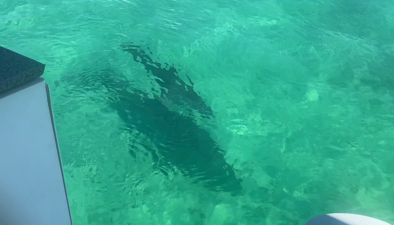
A dolphin cow and her calf swam up next to our boat.
On Monday I boarded one of two pontoon boats that carried the 24 of us from my family who made the trip to the seaside and traveled from Destin Harbor out to an apparently famous local haunt called Crab Island. I imagined it would be a large rock tethered to the ocean floor that would be just big enough to be a curiosity for all the tourists flocking to the emerald waters there and was pleasantly surprised to find that Crab Island was actually a shallow part of the bay which allowed for people to walk with ease through the water without much risk of drowning. As with my thoughts on Sunday, I did not join in the aquatics and remained firmly on the boat, but I still enjoyed the time out on the water.
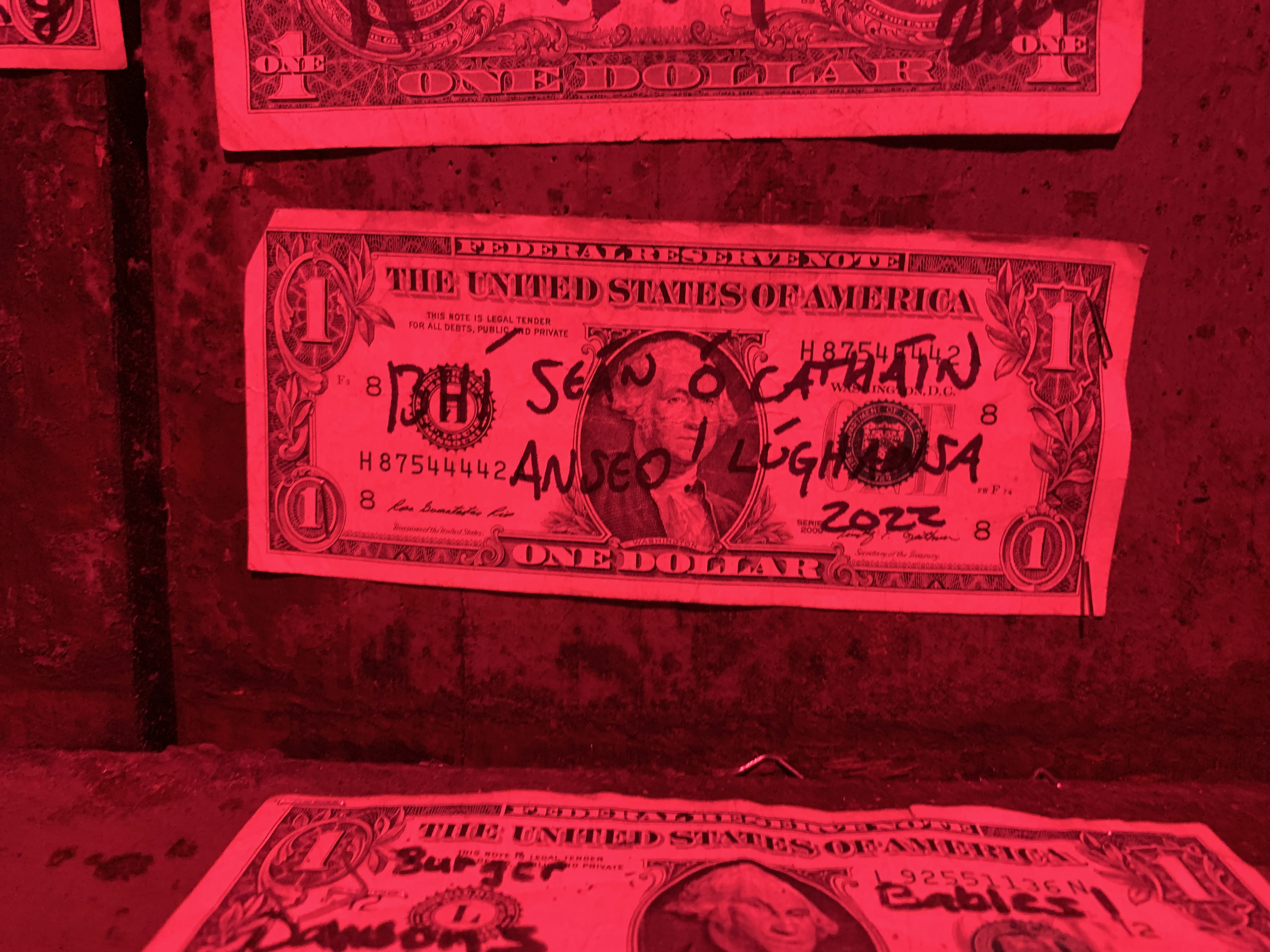
That evening several from our group went to a local pub in the area called McGuire’s that reportedly has some of the best steaks in the country. I considered it but ended up trying their bangers and mash, which were so wonderfully memorable. While I was there, I participated in an unusual custom local just to that establishment of signing dollar bills and stapling them to the walls of the pub. In my own case, my dollar bill was signed “Bhí Seán Ó Catháin anseo, 1 Lúnasa 2022.” After the fact I kicked myself realizing I forgot a key part of the verb, which should have been written “Bhí Seán Ó Catháin anseo é, 1 Lúnasa 2022.” Still, should you be in the area and want to see it, my dollar bill is likely there stapled onto the lid of a very large barrel (I thought of it as a hobbit door) in the room behind the gift shop.
My dollar bill at McGuire’s Pub in Destin, FL.
On Tuesday I got to experience the power of the thunderstorms that build up on the Gulf of Mexico. Most of Tuesday the skies remained cloudy and gray, with various stages of rain from sprinkles to showers falling down on the barrier island that we were staying on. The island in question is the easternmost reaches of Santa Rosa Island, a long and skinny barrier island stretching from Pensacola Harbor in the west to Destin Harbor in the east. Yet as a great many cases in this country’s long history longstanding naming conventions couldn’t be allowed to get in the way of a good marketing opportunity, and in 1950 at the urging of a local developer the eastern 1/3rd of Santa Rosa Island was transferred from Santa Rosa County to Okaloosa County and renamed Okaloosa Island, the name you can buy on keychains, t-shirts, and tag on your Instagram stories when you visit.
We stayed in a beach resort on Okaloosa Island called Destin West. The resort is split between a bayside horseshoe and a beachside block. Our condo in the middle of that bayside horseshoe was a 7th floor penthouse with a neat rooftop balcony that provided marvelous sunrise and sunset views over both the Gulf of Mexico and Choctawhatchee Bay. What’s more, I was delighted by the visions of the night sky that flickered into view each night from that rooftop. On Sunday night my parents and I ventured up onto our rooftop and spent a good hour gazing up at the stars. The sky was first illuminated by the pinpoint of light that is Arcturus, roughly 36.7 light years distant from Earth. Thereafter we gazed up, me laying in a sun-bathing chair, as more and more stars greeted us as the light of our Sun faded further below the western horizon. My Dad and I saw an even better view of the night sky a few hours later when we wandered down to the beach to try and get some wave recordings for this podcast, seeing then the band of the Milky Way arc over our heads in all its nebular glory.
I’m sad to report the wave recordings came out as static. I guess I needed a better microphone.
The other great highlight from the week in Destin was all the time I got to spend with my family: parents, cousins, aunts, uncles, grandparents, and the young children of my cousins. Many of you are listening or reading this week, and I hope this makes my appreciation for all of you very clear. On Tuesday night, I went out on the town with some of my cousins, going towards Destin’s Harborwalk where we enjoyed some of the local music, some good food and drink, and for several of my kin a nice jump off a perfectly good tower. A few days later I returned with more relatives, this time parents and kids included, and got to rediscover that Harborwalk all over again in the daytime.
One of the more fascinating experiences that I had while on the Emerald Coast was visiting first the Native American mound located in downtown Fort Walton Beach, and secondly a sea turtle conservation center in Navarre Beach. The mound was likely built around 850 CE by a people identified archeologically as the Pensacola Culture (fl. 1100–1700). The mound builders in Fort Walton Beach were among a wider culture of mound builders extending throughout the interior of North America called the Mississippian Culture who dominated the Mississippi Basin from around 800 to 1600. Among the most famous Mississippian mounds is Cahokia, located just across the Mississippi from St. Louis in Illinois, which remains one of the top archeological sites I still want to visit. The Mississippians mysteriously disappeared just before the arrival of the Europeans in North America without much certainty as to why. I for one would love to learn more about them.
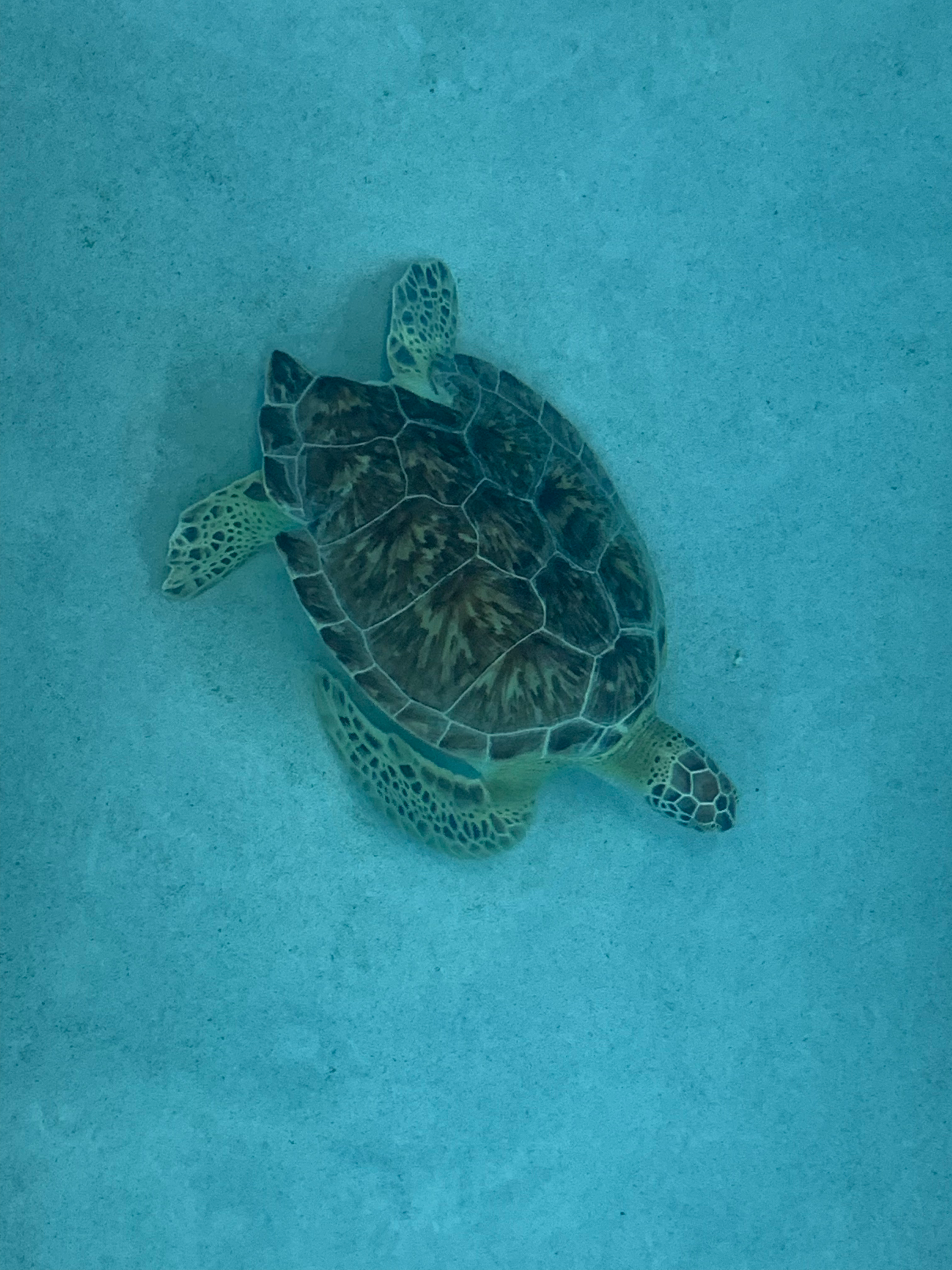
The Navarre Beach Sea Turtle Conservation Center has a lot in common with many a local science center that I’ve visited, including Broome County, NY’s Kopernik Observatory. It’s staffed by locals who clearly are not only dedicated to the center’s mission but are also themselves keeping the lights on, and it seems to be a focal point of a local advocacy message within the community. The Gulf Coast is home to a wide range of animals and plants, among which are several species of sea turtles. We got to see one green sea turtle named Sweet Pea who lives in the pool located inside the Conservation Center. Sweet Pea was found in Gulf Shores, Alabama with fishing wire stuck far down her throat and wrapped all around her body. In the veterinarians’ efforts to save her they ended up having to amputate one of her front legs, and she’s also missing a piece of her shell, but now she lives a happy life in her pool. Sea turtles are increasingly threatened by human activities along the coast, including fishing, littering, and the use of white flashlights on beaches at night which keep the sea turtles from laying their eggs in the sand out of fright. This is one area where sea turtle conservation and astronomy intersect, as in both cases red flashlights are far better to use than white or blue ones, as red is a cooler color and less blinding to the eyes of either a human or, clearly, a sea turtle.
Sweet Pea the Green Sea Turtle.
Over the last few days of my time in Destin I got to know the roads leading out of that resort town quite well, volunteering to drive a parade of relations to the local airport for their own flights home. On Friday morning, 5 August, I made my own departure from Destin, driving north toward Interstate 10 which I took east. I first stopped in Tallahassee, the state capital, with the sole intention of seeing the Florida State Capitol and then returning to the highway to finish my drive southeast to Orlando. As it turned out, I ended up getting lunch at a local Whataburger, refueling, and making a very brief stop at the State Capitol to photograph it, resulting in an hour delay in Tallahassee. This pushed my arrival in Orlando back from late afternoon to early evening, yet that was only the first delay.
One of the things I noticed foremost about driving on Florida’s highways is how aggressive the drivers in the Sunshine State are. In the Midwest if the speed limit is 70 mph the traffic might flow at around 75-79 mph, yet here with a similar 70 mph speed limit the traffic was staying steady if forceful at a grander 85 mph. I quickly caught on and kept up with the traffic, finding I was getting cut off and being honked at less by the locals and tourists alike, and after a few hours of driving I merged off I-10 and I-75 and onto Florida’s Turnpike, a tollway which runs northwest to southeast across Central Florida and then down the Atlantic coast until terminating near Miami. I was excited to see what this turnpike would be like, as every state tends to like to give their tollways their own particular flair. Massachusetts for one has grand signs arching over their turnpike at every service plaza, and Illinois––the state of my birth––used to have a network of toll oases that were glass bridges over the tollways, most of which are now gone, though they’ve kept the very large circular oasis building on I-88 in DeKalb. Florida’s Turnpike proved to be about as overstated as I expected, with its grand service areas that were advertised nearly once every mile.
I wasn’t planning at stopping at any of them but ended up pulling over at the first one I came across because of a warning sign I saw almost as soon as I’d merged onto the turnpike: “All lanes blocked at US-27 due to wreck, find alternate route.” I checked my map and confirmed that US-27 was between where I was and Orlando. So, I turned to my car’s navigation system and found an alternate route that would take me off the turnpike before the wreck and back on again just after it. “Great!” I said, pulling back onto the highway. It was only a half an hour later when I was pulling off the turnpike and onto my alternate route that I began to realize how frustrating this would be, as that alternate route took me from a 70 mph highway onto a series of rambling backroads that led to the northernmost suburbs of Orlando where farm traffic mixed with the Mercedes and Volvos going to and from the new neighborhoods and resorts that were being built in those farm and swamp lands.
Finally, finally after another hour of meandering through the backroads of Central Florida I returned to the turnpike well past the wreck that had shut down “Florida’s Main Street” and into one of Central Florida’s famous summer thunderstorms. Now, I’m from Tornado Alley so I know a thing or two about thunderstorms, but I can swear to you now that these Florida thunderstorms are nothing like the ones that build up off the eastern face of the Rockies and rain down on the Great Plains. Oh no, these are tropical downpours that build up as the cold Atlantic air meets the warm Gulf air over Central Florida, itself a barely-above-sea-level peninsula and proceeds to dump all the water the heavens can muster onto anyone below. It reminded me of what the Ferengi on Star Trek: Deep Space Nine say about the rains on their home planet Ferenginar, “No, it never rains, it only pours!” As a matter of fact, the hyper-profit hungry Ferengi may well be a good model for understanding Florida, or what I saw of Florida, a state that has a noticeable government bureaucracy (just look at all the tollways around Orlando) but maintains a strong “Survival of the Fittest” attitude about life. I even argued on multiple occasions during my time in the state that they ought to change their state motto to that: “Florida, the Sunshine State. Survival of the Fittest.” The remainder of my time in Florida was marked by the threatening clouds of its immense thunderstorms.
I stayed in the tourist area south of downtown Orlando near International Drive with the idea that if I was close to a couple major highways, I’d be able to get to my two main destinations on that part of the Longest Commute easier. Still, I was overjoyed to discover that I was effectively staying in a part of town that could be called Chicago South, for no sooner had I gotten there than I realized there was a new Portillo’s location just a few minutes’ drive from my hotel. For those of you who aren’t aware, Portillo’s is a chain of Chicago restaurants serving local favorites from the city of my birth like Chicago hot dogs, Italian beef sandwiches, Maxwell St. Polish Sausages, Italian Sausages, as well as burgers, salads, and Mrs. Portillo’s famous chocolate cake. And yeah, I may have eaten there a few times while I was in the area, seeing as I haven’t gotten back to Chicago since 2020 yet.
On Saturday, 6 August I decided to go into Orlando and see what there was to see in a city famous for its theme parks that wasn’t actually in a theme park. I was kind of interested to go to Disney World again, 25 years after my last visit at the age of 4, in large part because there was a rumor (I could never confirm it) that they have a toco toucan (Ramphastos toco), which is the one that’s at the center of the action in Chapters 5 and 6 of my dissertation. Yet with all that said it turns out that the Orlando theme parks are far too expensive to visit on a TA stipend, especially when you’re just going as an individual and not with a significant other or a group. So, instead I went to visit my two usual haunts in a new city: the local science museum and the local art museum.
A vertical farming demonstration
The Orlando Science Center is located in a large round building on the edge of a city park that was built in the 1990s. It houses a lot of wonderful science exhibits aimed at introducing children to the main topics of the STEM fields, and it’s clear the children of Orlando get a lot out of that museum, which is wonderful. The one hall that I spent a fair bit of time in, the one hall that was the closest to what I’ve come to expect in a science museum, was the dinosaur hall, where a series of casts of famous fossils were found, including a cast of Stan the T. Rex. That said, I was out of the Orlando Science Center in just over 30 minutes, having seen pretty much the entire place. Thankfully, my ASTC membership got me in there for free.
From the Science Center I decided to walk across the park to the Orlando Museum of Art, a pretty building set into the far edge of the park from the Science Center. I paid my admission fee and began to stroll around their limited galleries, finding one on Ancient American art especially fascinating, but the rest of it, a collection of contemporary art from around Florida, was not really my style. I do love some types of contemporary art, especially contemporary architecture and the smooth lines that evoke it in paintings and sculpture, but I’m not as fond of the imperfections that seemed to be glorified in the art on display in that museum. It’s just not my taste. A bit let down by that experience, on the walk back to the car I searched on my phone for another museum I remembered seeing when I was researching this trip, and while I thought I found it I instead ended up at the art museum on the beautiful campus of Rollins College, one of the top liberal arts colleges in the South, and somewhere based on what I read and saw of the place I wouldn’t mind teaching at someday, perhaps.
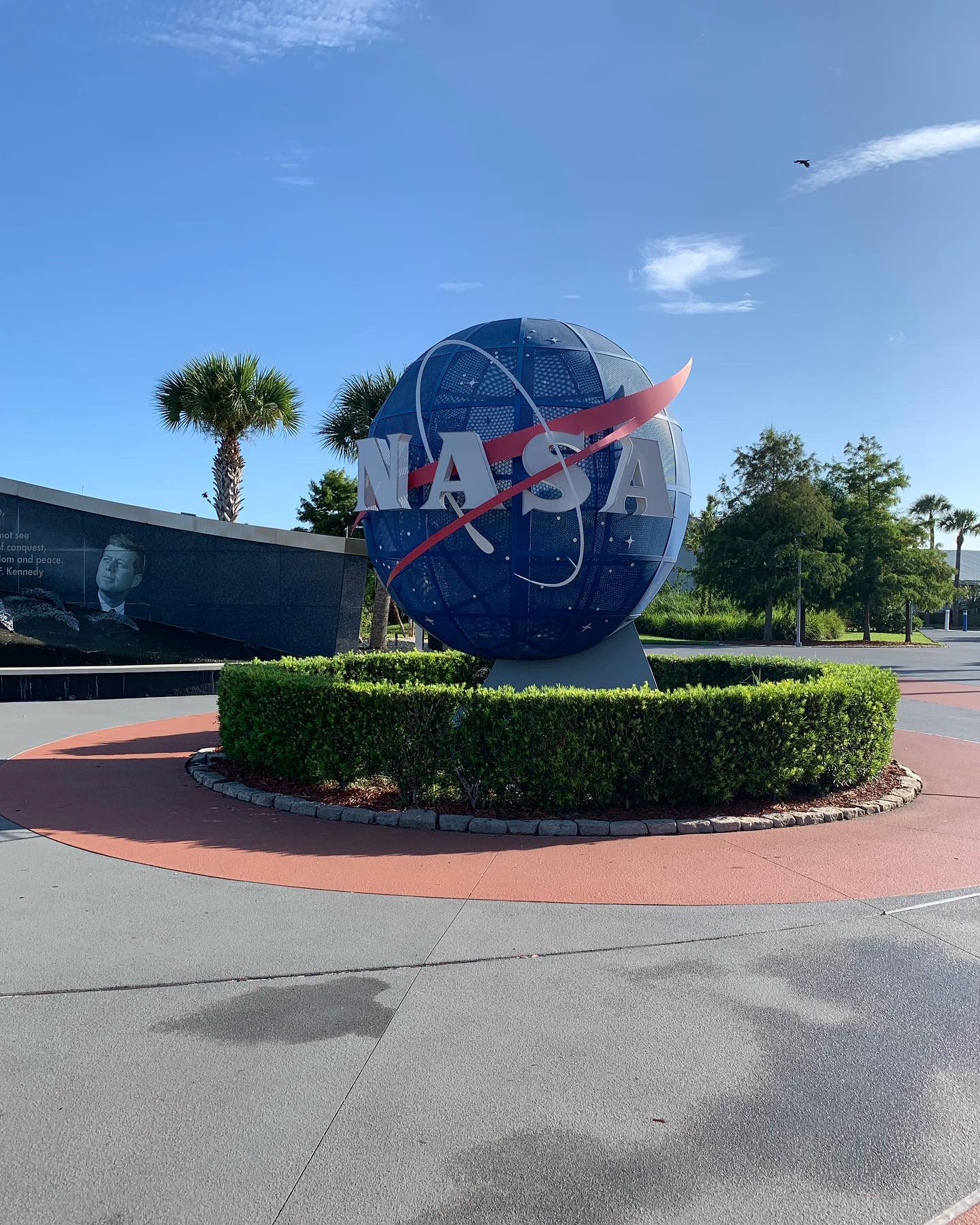
The main reason why I chose to go to Orlando was to use that city as a launching off point for a day trip east to the Kennedy Space Center at Cape Canaveral. Some of my earliest memories are of pictures from the Apollo program and of the space shuttles in books and on TV. Those of you who have read and listened to the Wednesday Blog (thank you!) will know that I’m a space nerd. So, when I heard we were doing a family trip to Florida, I first looked up how far our vacation spot was from the Cape.
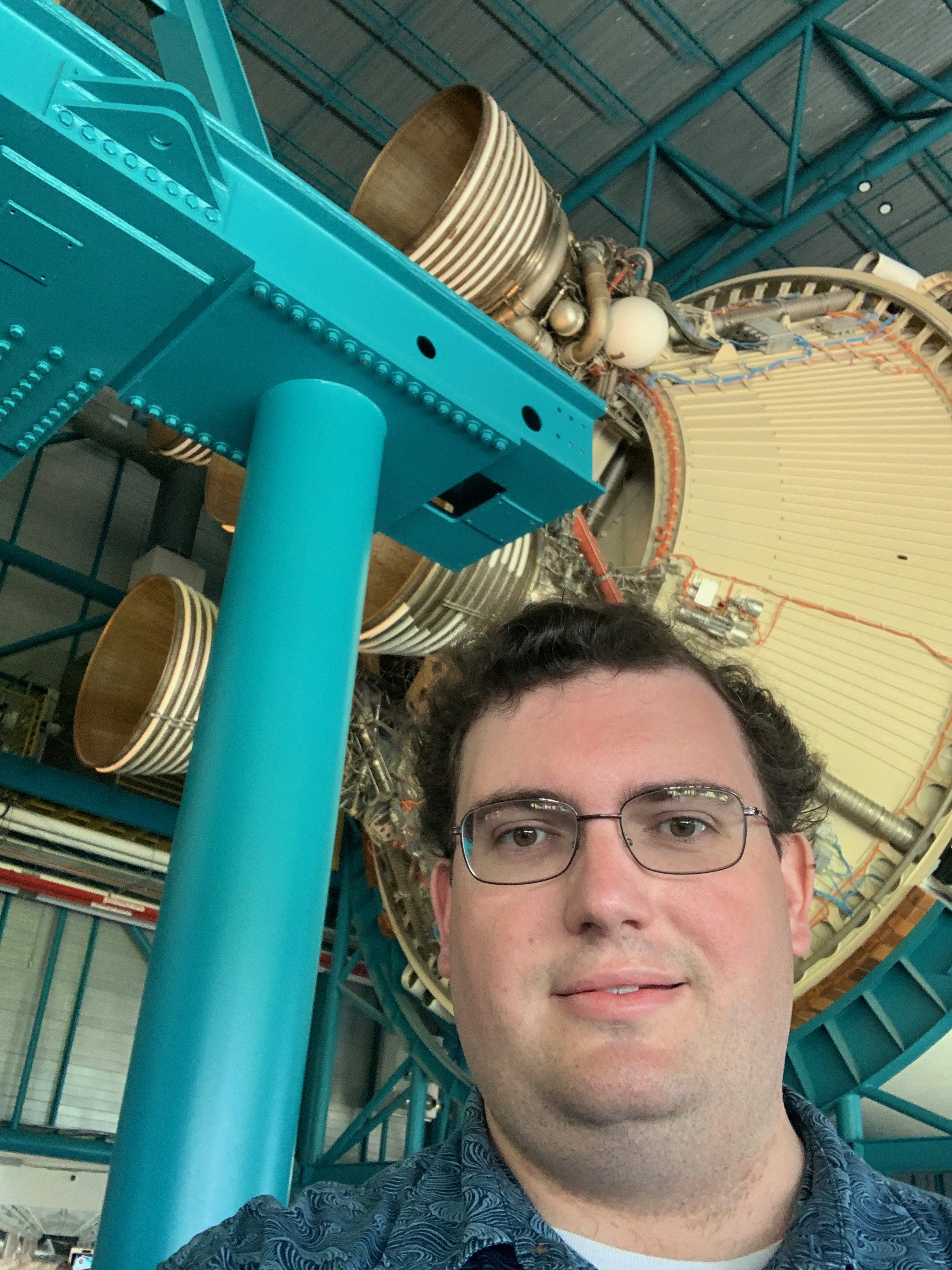
I arrived at the Kennedy Space Center’s Visitor Complex at 8:15 am, a full hour and 15 minutes before the gates opened, which meant I was also one of the first in line to go through those gates when they did open at 9:30 am. The opening of the Visitor Complex every day is announced by the playing of the national anthem over the PA system, in a rousing and triumphal manner that proved to be a sign of things to come. I began my tour of the KSC by catching the tour bus to go out to the Apollo-Saturn building a few miles northeast from the main Visitor Complex near the Vehicle Assembly Building, where NASA’s spacecraft are put together and stored before launch) and launchpads 39A and B where both the Apollo missions of 1969–1972 and the Artemis missions of my generation have and will launch from. At the time that I visited, 7 August 2022, Artemis 1 was housed inside the Vehicle Assembly Building awaiting its launch to orbit the Moon. The launch window is scheduled for 29 August at the earliest, a few days after this episode is scheduled to be released. So, fingers crossed that it works!
In the Apollo-Saturn building I got to see a mockup of the Apollo mission control, a Saturn V rocket, and an inspiring half-video, half-staged performance telling the story of Apollo 11’s landing on the Moon in the summer of 1969. I found all the videos that greet you when you enter each building at the KSC to be quite triumphant and grandiose in their tone and music. It’s actually quite fun, though a bit jarring in our current climate of division and fear in this country.
A Saturn V rocket in the Apollo-Saturn Building.
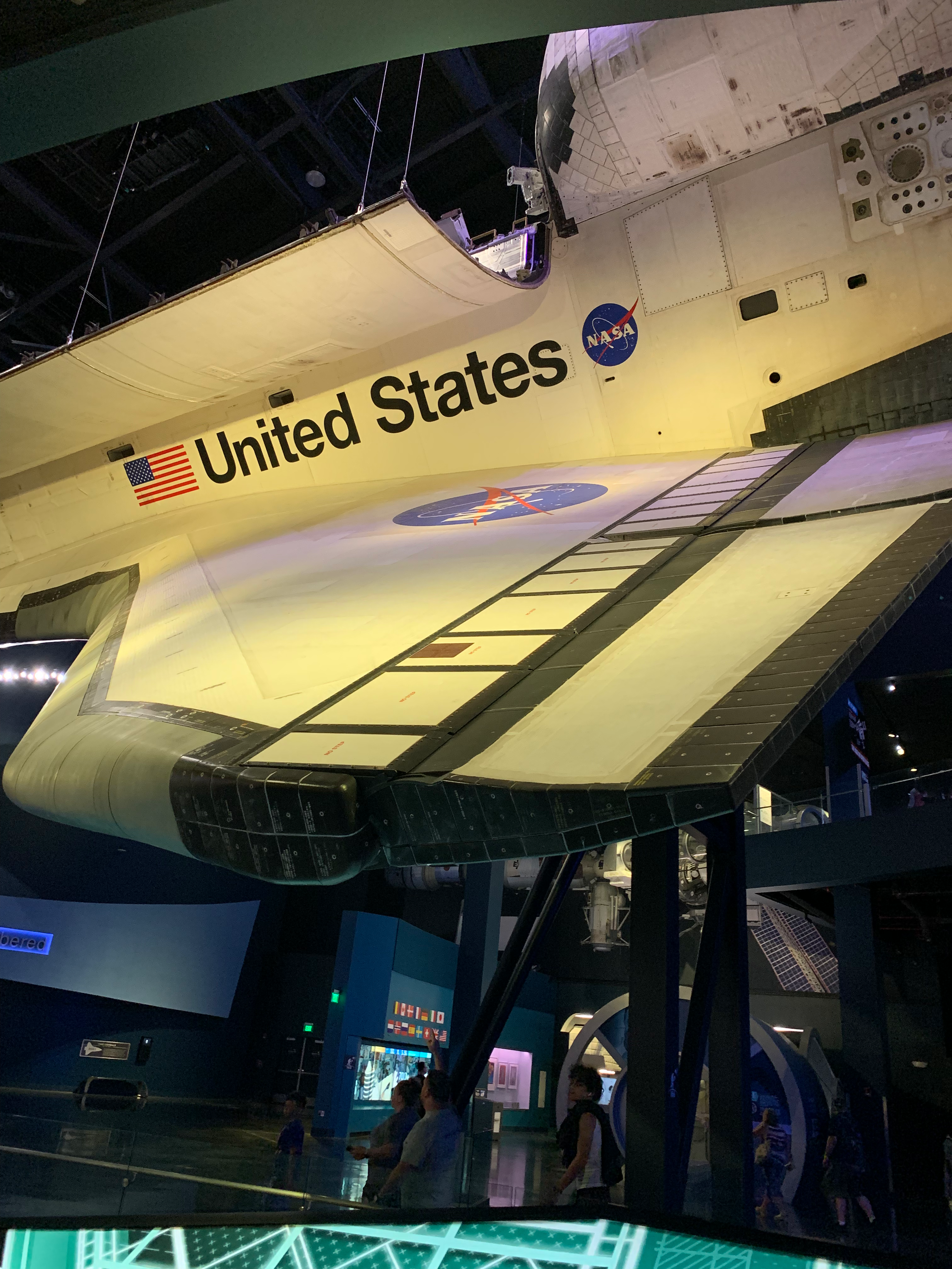
The building I liked the most was the Atlantis building, which houses the Space Shuttle Atlantis and honors the space shuttle and ISS programs all together. As much as Apollo and Sky Lab were the space programs of my parents’ youth, so the Space Shuttle and ISS were the space programs of my youth. It was quite moving for me to finally see a space shuttle up close, and the feelings of bitter sadness that I felt when the shuttles were retired in 2011 returned ever so slightly. I was almost moved to tears seeing the memorials in that building dedicated to the Challenger and Columbia crews who lost their lives in 1981 and 2003 respectively. Many people in my parents’ generation have said that they stopped watching space launches after Challenger broke up upon liftoff, and as for myself I can remember when the news bulletin came in on NPR announcing that Columbia had broken up upon reentry into the atmosphere on that warm Sunday, 1 March 2003.
The Space Shuttle Atlantis
My Dad and I were out in the fields on our farm, doing what I can’t remember, and he kept the radio running in his truck that time. As I heard the news I remember looking up to the south and seeing a jet trail far up in the sky. Now, I know that Columbia broke up over Texas, not Kansas, but in my memory that jet trail was Columbia in its last moments. It’s a memory that will always stick with me.
After a nice lunch in the Cosmic Café, I returned to my touring, visiting the Mars building to see the end of an inspiring video telling us “The first human to walk on Mars is living among us today!” with a NASA employee up on the stage pointing out into the audience saying proudly “and that person could be one of you!” I for one am curious about the idea of going up into Space, maybe someday I’ll do it, but for now I don’t think I’m healthy enough for it. From there I walked over to the new Gateway building, which houses a collection of new and newly proposed spacecraft from NASA’s commercial partners including SpaceX, Boeing, and Lockheed Martin, among others. One example from a company whose name I can’t remember was an expandable space habitat which at its full size is 3-storeys tall and can serve as a home, workplace, and laboratory for the astronauts onboard whether in orbit, in transit, or on the surface of another world.
My final stop at the KSC was in the Heroes building, an exhibit which honors the NASA and allied astronauts who have ventured up into Space over the last 60 years beginning with the Mercury 7. The building culminates with the NASA Astronaut Hall of Fame, at the center of which stands a fine statue of astronaut Alan Shepard, the first American to leave our home planet in 1961.
I left the Kennedy Space Center at 3 pm, a good 6 hours after I first passed through the entry gates, having fully enjoyed my day. The one thing, after leaving and now writing about that experience that I wish I’d done is bought a pack of NASA themed playing cards that were for sale in the gift shop.
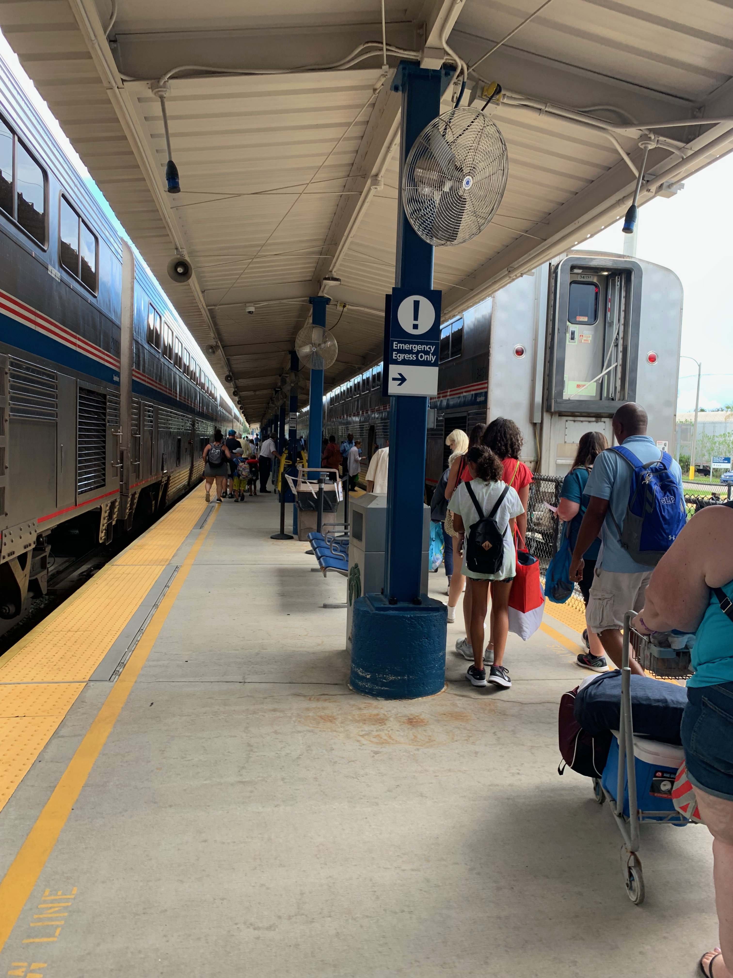
The following morning, I was up at 9 and out of my hotel by 10:45 for one of the most memorable legs of any trip to date. I was leaving Florida not by road but by rails. At 12:30 I had the Mazda Rua loaded onto the car-carriers attached to the rear of the Auto Train and boarded it myself at 15:30, sitting happily in my sleeper compartment, my roomette, when we pulled out of Sanford, Florida at 5 ‘o clock that evening. I enjoyed the complimentary dinner service in the dining car, choosing the Amtrak Signature Flatiron Steak with green beans and a baked potato, along with a starter salad with Newman’s Own Light Italian dressing, a dinner roll, and a glass of Chardonnay. The 3-course meal was finished off with a slice of cheesecake, a sign of where I was headed, back to the Northeast after an overnight stop in the DC area.
I fell asleep on the night of Monday, 8 August somewhere in southern South Carolina to the gentle sound of the rails beneath me, the soft swaying of the Superliner sleeper car an old and comfortable feeling to me, having experienced it a handful of times on the Southwest Chief between Kansas City and Chicago. Sleep came late, with dreams of an old Mozart tune floating in my head. “Bona nox …”
Over the last 3 years I have driven between Kansas City and Binghamton, New York twelve times, that adds up to around 15,600 miles of driving in total. It’s a lot of time on the road, and in the last few weeks I’ve begun to think of this period in my life as my Years of Wandering, a period when I have been practically migratory in how I’ve moved across the country so often. Surely at this point the postal workers in Binghamton and Kansas City recognize my name for how frequently I’m asking my mail to be forwarded from one address to another. Still, I am in a far better position professionally today than I was after my first master’s degree in 2016. And looking ahead now, the future really is bright for me. I’ve got a lot of opportunities over the horizon.
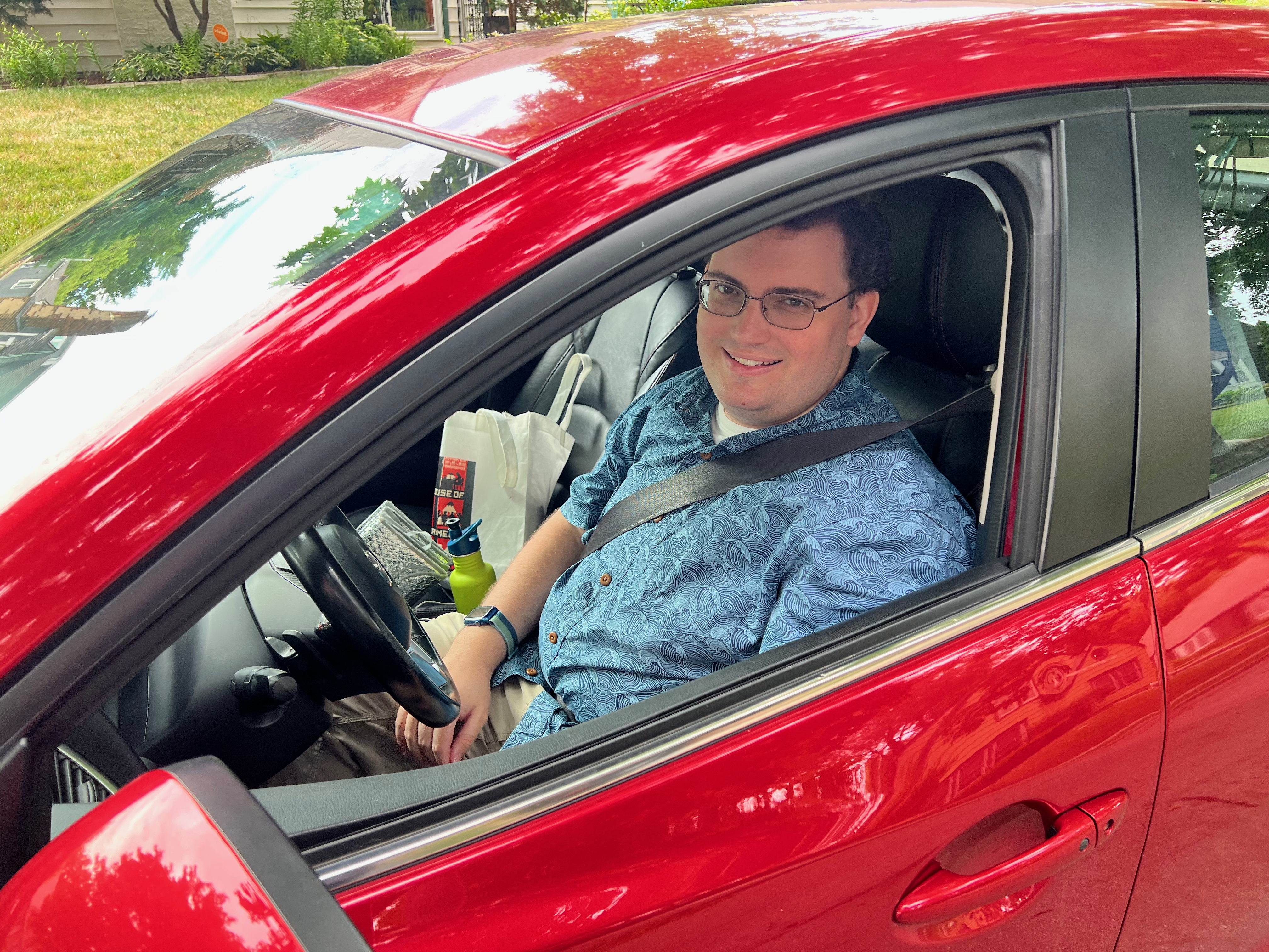
With all this in mind, I woke up at the reveille of my 06:45 alarm on Friday, 29 July 2022, as is usual, and ruminated on a strange dream I had been having involving, people singing the Internationale while making strange hand gestures and being overly polite, all as a part of a protest over fish. Must’ve been the wine the evening before. Regardless, I woke up that morning knowing exactly what I needed to do: it was time to strip my bed, start my regular morning routine, and begin packing up the car for the next Long Drive East.
To date this drive is the earliest I’ve ever left to return to Binghamton for the Fall semester. Its predecessor in that record was the original Long Drive East on 1 and 2 August 2019, after which I decided I would never again make that trip so early in August again. I intended to keep that promise, even through the period of 14-day quarantines in 2020, yet here I was, on the 29th of July packing the car for the Long Drive East, a drive that would end in a muggy humid valley in Upstate New York that feels about as far from home as it could be while still being in the Lower 48. So, after a quick breakfast of sourdough French toast, scrambled eggs, and hash browns with some friends, I left home at 10:00, bound for my first refueling stop in St. Louis.
The normal Long Drive East has four refueling stops, one every four hours. Typically, they are St. Louis, Indianapolis, Columbus, and Erie. That is if I take the fastest out of the possible 10 different routes. In this instance, I intended to keep to form and barrel my way across Missouri without stopping between Kansas City and St. Louis, so as to get the trip off to a strong start, and maybe to make better time at my overnight stop. But, as things have happened so often this summer, the first day of the trip didn’t quite go to plan. Rather than making it all the way to St. Louis without stopping I decided midway across the state to make a lunch stop in Columbia, home of Mizzou (the University of Missouri to the rest of humanity not from the Midwest). Already by that point I was beginning to feel pretty tired, and knew I needed at least a few minutes of a break. With that in mind, I made an early stop, and shrugged it off, opening the door for even more unscheduled stops over the rest of the trip to come.
This particular Long Drive East was different from every other one that I’ve done over the past few years. Sometimes, I might include a day or two of sightseeing along the way, as an extra bribe to myself to go through with driving so far for so long. The last time I did that was in January 2020 when I stopped in Pittsburgh for a couple days to see the Carnegie Museums. In the years since I’ve allowed myself half-day stops here and there, like at the Cleveland Museum of Natural History in August 2021. In all of those occasions I rarely detoured from the general Great Lakes region that lies between the Great Plains where Kansas City blooms and the Appalachians where Binghamton is nestled among those low mountains along the banks of the ancient Susquehanna River.
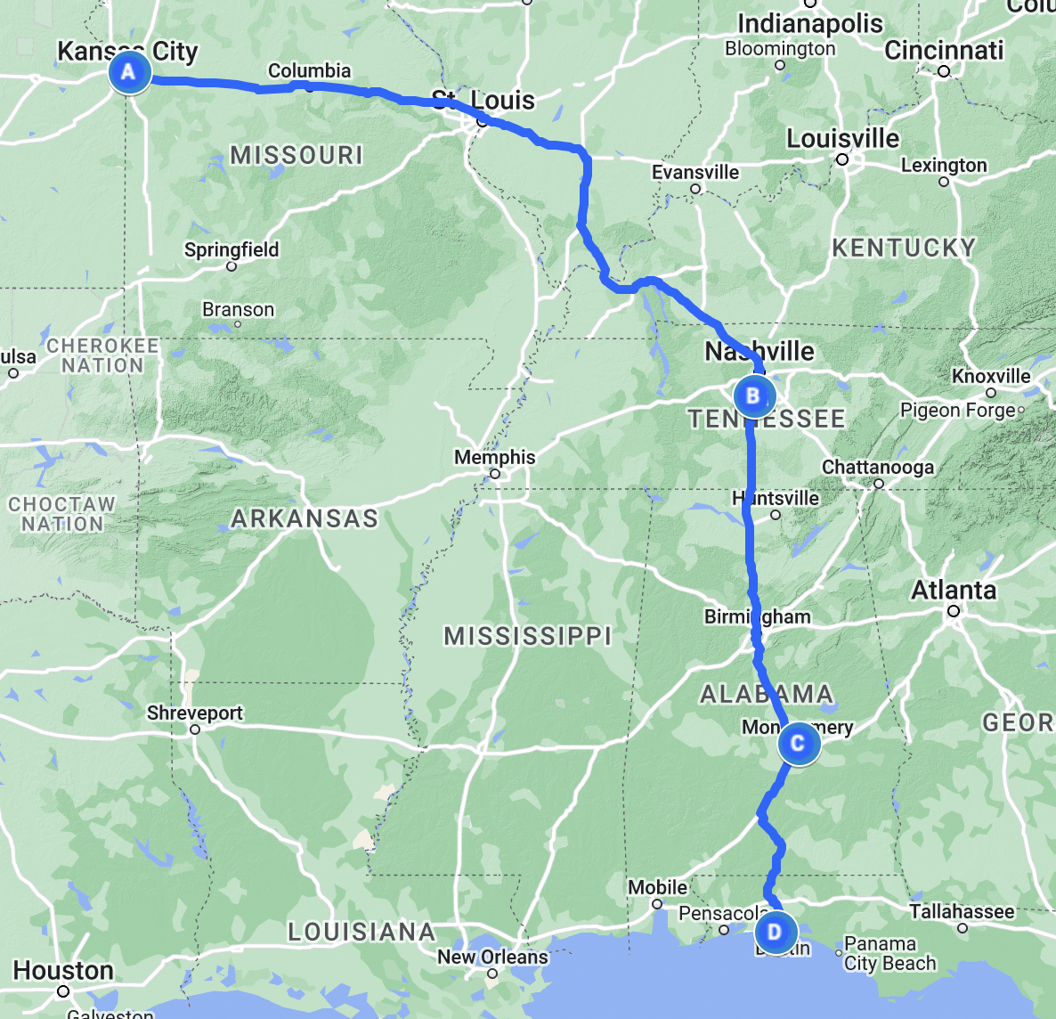
This time I was taking a long way around, not exactly what I’d call “the long way around”––that would be driving to Binghamton via Alaska––instead, I planned to return to Binghamton via the South, the one region of the country (besides Alaska and Hawaii) that I’ve spent the least amount of time in. Why would I add an extra 1,430 miles (2,301.36 km) to my route just to do a bit of sightseeing? Family, that’s why. This year my family decided to hold a reunion in Destin, Florida, a small resort town on the Emerald Coast of the Gulf of Mexico that lies about halfway between the larger Northern Florida cities of Pensacola and Panama City.
Of the 24 of us who went to Destin this Summer about half made the trip by air along various routes, while the other half of us drove. I decided from the first moment I started planning this trip that I wanted to stick to the interstates as much as possible, seeing as I memorized most of those over years of staring at maps during road trips as a kid between Chicago and Kansas City. Most of the drivers chose to take a slightly faster route on US Highways through the Ozarks stopping overnight in Memphis and Tupelo, Mississippi (Elvis’s two hometowns). In my case, my goal for the first night was Franklin, Tennessee, a suburb south of Nashville along I-65. So, naturally as I drove across Missouri, I was repeating from time to time the general route I was following on that first day: I-70, I-64, I-57, I-24, I-65. As long as I kept those numbers in mind, I knew I’d make it to Franklin eventually.
I arrived in St. Louis around 13:30, about 2 hours later than I usually would on a Long Drive East. Granted, I also left Kansas City 2 hours later than usual, choosing that wonderful breakfast at Eggtc. over the typical simpler breakfast at home or the quick sandwich & doughnuts that I’d normally pick for such a trip. In the days before I left, the St. Louis area had been badly flooded by heavy rains, with some places in St. Charles County even seeing a foot of rain (30 cm) fall in the course of a day. The reports showed homes inundated, metro stations submerged beneath 21st century ponds, and highways deep under water. I was concerned that the aftereffects of the flooding might close some of the highways I needed to take, particularly I-70 in St. Charles County and I-64 across St. Louis County and City, but thankfully it was smooth sailing the entire way to the Arch.
I crossed the mighty Mississippi on the Poplar Street Bridge and left Missouri behind for the second state, the state of my birth, Illinois. Now the thing to say about Illinois from the start is that as much as it is the state of my birth, there is a tremendous difference between Chicago and the rest of Illinois, just as there is between any metropolitan area and the rural countryside in between across the United States. So, as much as I do kind of feel at home even there in Southern Illinois, it’s still not exactly the same as the place that I still call my original home a couple hours’ drive to the north of St. Louis. This trip marked the first time I drove southeast out of St. Louis on I-64, which is the main road between St. Louis and Louisville, continuing on from there eventually to Richmond and Hampton Roads, Virginia. I was only on I-64 for a short time, little more than an hour, when in Mt. Vernon, Illinois I left that east-west route and turned south on I-57, a highway I usually encounter in Effingham, Illinois, to head towards the furthest reaches of that state of my birth, to a place I’d long heard of and wondered about.
When I was 5 or 6 my parents bought a beautiful cloth-bound hardcover photographic atlas of the United States that was probably a special millennium edition. I remember the inside cover had a photo of a mountain climber scaling an ice-covered cliff on one of the mountains either out in the Rockies or up in Alaska. But as I drove through the southernmost reaches of Illinois, what came to mind the most was the photo of the Fall colors in Shawnee National Forest, which covers 280,000 acres (1,100 km2) of woodlands near the confluence of the Ohio and Mississippi Rivers. As a child, I always was amazed that there was a national forest in Illinois, I had only ever encountered national forests out in Colorado, and so to me that meant they must be truly wild places with great mountains and old trees and lots of animals. Shawnee National Forest certainly has some hills, the Ozark and Shawnee Hills to be precise, but the years since has tempered my initial surprise through time spent in the national forests of the Appalachians.
I crossed the Ohio at Paducah, entering the Commonwealth of Kentucky. I last visited Kentucky in September 2018 when I attended the Midwest Conference on British Studies at an Embassy Suites in Lexington. My experience of the state this time was largely the same as that time, only I’m happy to report I-24 is far less potholed than I-75 was the last time I drove it between Cincinnati and Lexington. I crossed Kentucky quickly, I-24 crosses only 93 miles in that state before entering Tennessee. While in Kentucky though I did see the first big dark clouds that marked the latest round of flooding, this time not in St. Louis but in Eastern Kentucky.
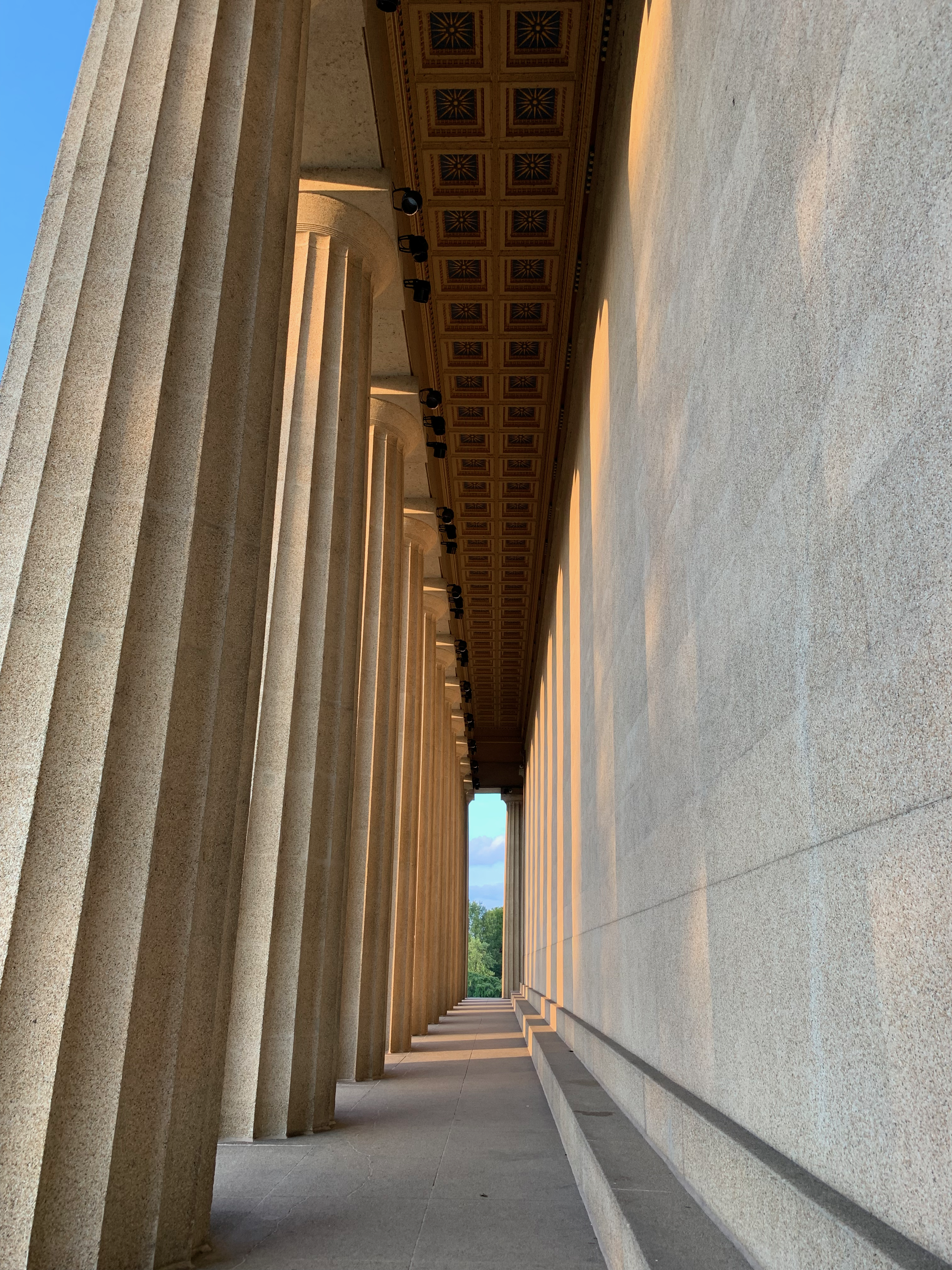
As I left Kentucky for Tennessee, I began to enter a far hillier area that makes up the northern rim of the Nashville Basin, a great bowl surrounding the state capital. Traffic picked up as I descended into the bowl, reaching the I-24/I-65 junction north of Downtown Nashville. Back in Kansas City I had chosen to enter the address of the top site on my tourist list in Nashville into my navigation system, and so I left I-65 early of my hotel for Centennial Park and the Nashville Parthenon. This building is a full-scale replica of the original Parthenon located on the Acropolis in Athens. I arrived at 19:00, sadly a few hours after the interior had closed to visitors, and thus could not enter the building. Nevertheless, I gazed in wonder at the reliefs and ornate ceilings of the porticoes and stoas.
After a quick stop at the Parthenon, I made an even quicker stop at the Tennessee State Capitol, wanting to avoid the ire of the state police for spending too long on their property, and by that point having been on the road for a full 9 hours, I really needed to get to my hotel to sleep. With those two stops in Downtown Nashville done, I returned to I-65 and made quick work of the drive south to Franklin.
The following morning, I woke with my 06:45 alarm and staggered upright after the usual vivid and surreal dreams. There were images of me in quick step striding my way across a white sand beach on the Gulf Coast, dressed in a full business suit beneath the midday Sun. In my left hand my briefcase, my right hand raised aloft trying to catch some phantom bus that was due to roll onto the shore. Riding atop my head was my cat, Kitty, lazily lunging on my scalp as if unconcerned by the precariousness of her position.
I remembered what I had to do and quickly got ready for another day of driving. While the first day had taken me along roads I knew all too well, this day would pass along many roads I’d only ever looked at on the map. I left my hotel in Franklin at 08:00, stopping for a quick breakfast before turning my attention once more to I-65 and the continuing road south. The Tennessee hills glowed in the morning Sun, their green cover of foliage marking the southern end of the great Appalachian Mountains that I knew well in New York.
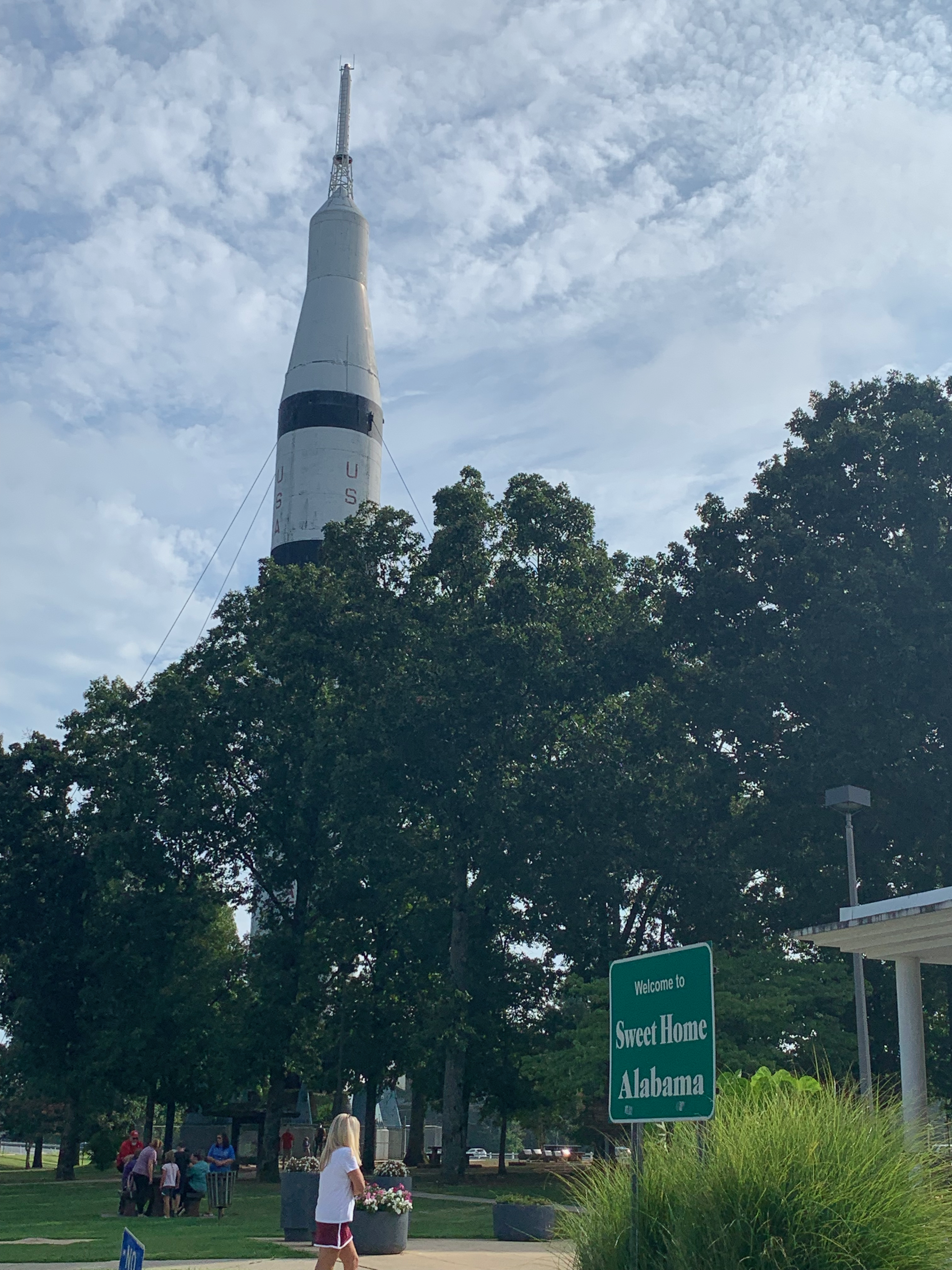
I made quick progress along I-65 to the Alabama border and soon found myself facing a Saturn IB, a NASA rocket built in Huntsville, Alabama. I pulled over into the Alabama Welcome Center parking lot and briskly walked over to the base of the rocket to take some pictures before returning to my own chariot for its continuing voyage rocketing ever southward toward far greener shores.
Alabama struck me as in some ways old fashioned, in other ways brilliant, as in how they included the mile markers on each bridge, a great way of calculating distances as I crossed the Heart of Dixie. After about an hour I entered the great valley where Birmingham was built, the largest city by far in the state. In Birmingham I began to truly notice that I was moving southward as I crossed over Interstate 20.
Here in the US, the Interstate highways are numbered in an ingenious way to help navigation: east-west highways are even numbered with the lower numbered highways in the south and higher numbered in the north, and north-south highways are odd numbered, with the lower numbered in the west and higher numbered in the east. Thus, with Interstates 5 and and 8, San Diego is the 0/0 point of the Interstate system, while Boston with its Interstates 95 and 90 is the exact opposite. There are some exceptions to the rule (I’m looking at you, I-99 in central Pennsylvania and New York), but by and large it’s a rule that’s followed nationwide. So, when I saw the signs for I-20, I knew I was making progress, especially when I started the trip in Kansas City on I-70.
Birmingham seemed like an interesting place, and while I didn’t stop there this time, I wouldn’t be entirely opposed to having a conference there in future years, if that happens. Nevertheless, I passed it on by and continued south toward my first waypoint of the day in the state capitol Montgomery. Yet after leaving Birmingham I was baffled to be stopped by bumper-to-bumper traffic that had occurred for no apparent reason. I sat in the southbound lanes crawling behind semis, RVs, boats on trailers, pickup trucks, and suburban soccer mom tanks (aka minivans) with every state’s license plate imaginable adorning their rear bumpers. The heavy traffic continued for the rest of the day’s drive until I reached the Gulf Coast late that afternoon.
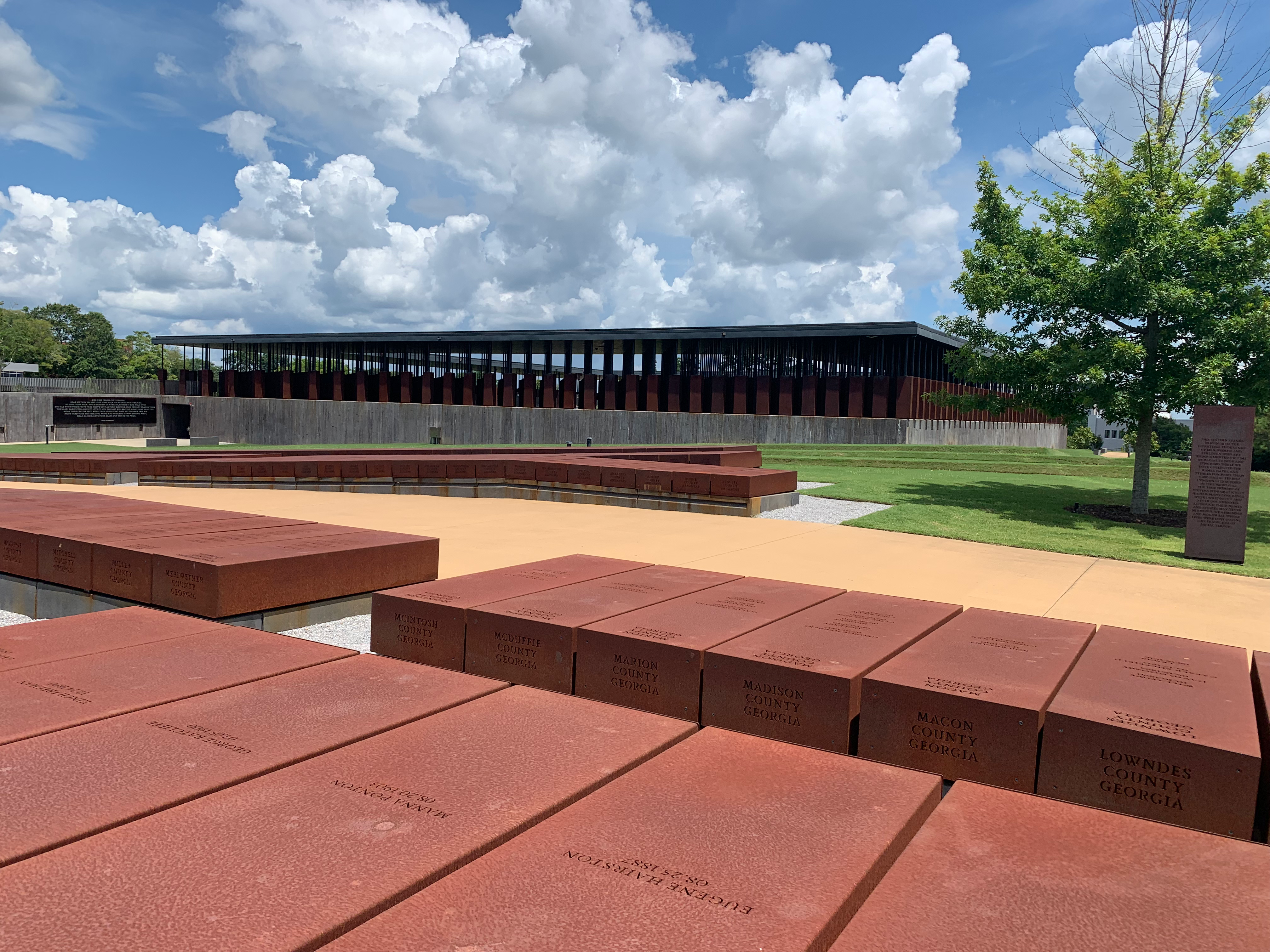
I reached Montgomery just before noon and drove straight to the main site I wanted to visit. The National Memorial for Peace & Justice opened in April 2018 to much press. A review at the time from The Washington Post’s Philip Kennicott called it “one of the most powerful and effective new memorials created in a generation.” I read all about it when it opened, and even looked into how I could travel to Montgomery to visit it. When I did arrive, I wasn’t disappointed. The memorial honors the African American victims of racially motivated lynchings that took place between the end of Reconstruction in 1877 and the beginning of the Civil Rights movement in the 1950s. The memorial is made up of a series of 805 hanging rectangular steel pillars representing each county where an African American was lynched in this country during that 73-year period. I was quiet walking up to the memorial, stunned by the sight of it. I knew what to expect, but I didn’t really grasp the power of that vision until I actually saw it in the flesh. How such racially motivated terror was, and frankly remains so common in this country is sickening.
My eyes stayed wide as I gazed first at the pillars that hung along the entry to the memorial and then slowly turning upward as I walked down into the heart of the site, a trench that was dug deep into the ground like some vast communal grave into which all these tormented souls were buried. Some of these pillars have been taken down from their original places aloft and placed on the ground in a series of rows like in a cemetery, those that have are the ones that represent counties that have established their own memorials to mourn those who were murdered this way locally. My own home county––Jackson County, Missouri––was included among those that have erected their own memorials, in our case to a man named Levi Harrington who was murdered on 3 April 1882 on a bridge in the West Bottoms. In June 2020 the monument in question was thrown down the cliffs on the western side of Quality Hill soon after its installation by several unnamed individuals. At this moment of writing, I can’t remember if it was replaced and fixed.
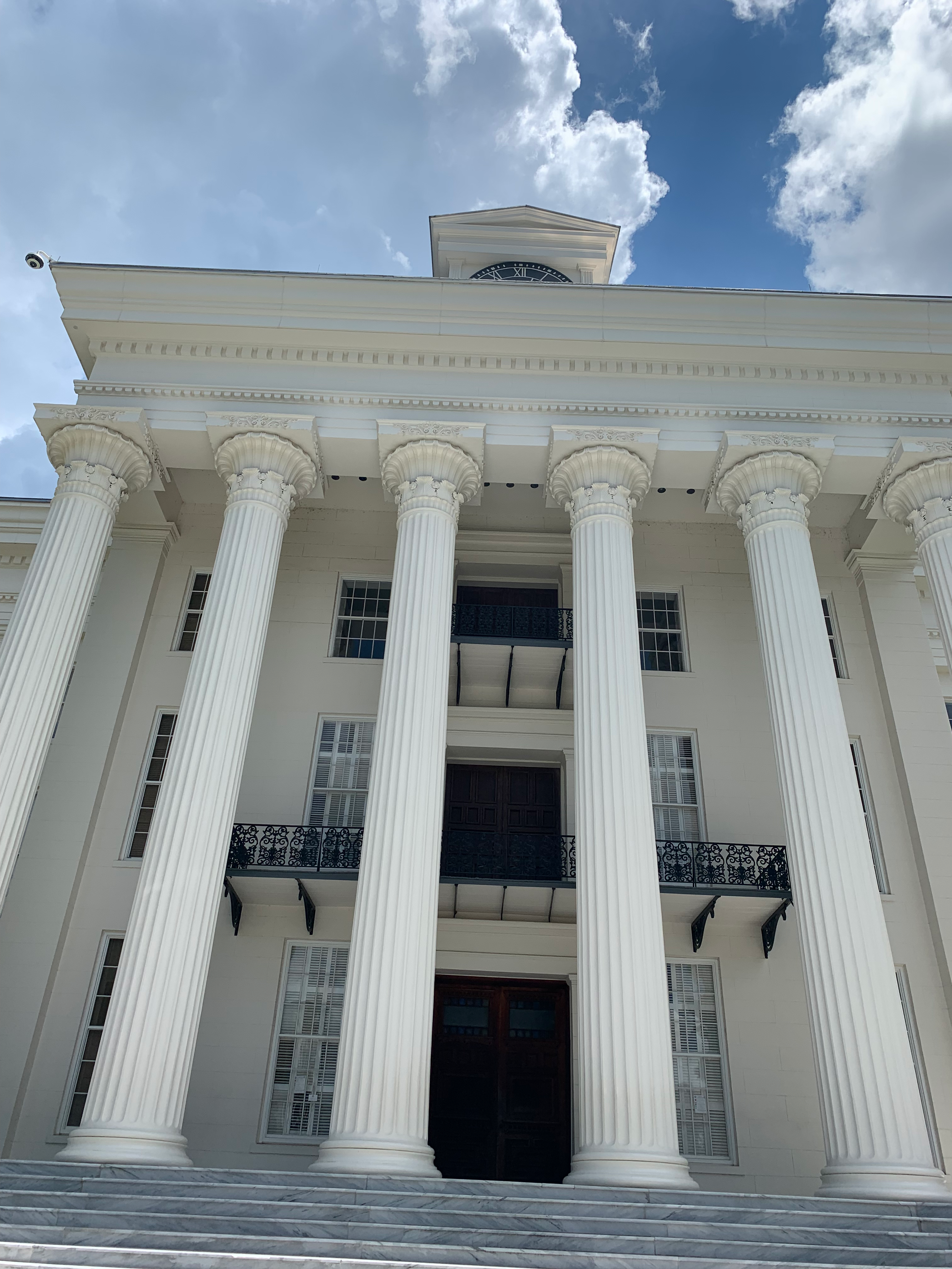
I left the memorial and drove into downtown Montgomery hoping to find lunch and make a stop at the Alabama State Capitol. Yet of all the things that could be confounding the parking situation was what kept me from making more than just the one stop on the capitol grounds. Every parking meter I stopped at had a red “Expired” sign waving like a most unwelcoming of flags before me. So, I decided the best place to risk getting ticketed for illegal parking was the State Capitol itself.
The Alabama State Capitol has a checkered history in my book. On 22 February 1862 it was the scene of the inauguration of Jefferson Davis as President of the Confederate States. While I was taking pictures of the capitol building’s white façade a guard walked over to me and asked, “You should get pictures of the statues as well, like Jefferson Davis over there?” I turned to the guard and quickly replied, admittedly without thought, “I don’t take pictures of traitors.” Alabama to me is the South personified, it was home to the first capital of the Confederacy, and the heart of the old Jim Crow South that perpetuated the evils of the old Southern way of life for generations after they were defeated in battle by the Northerners and Midwesterners. I myself didn’t have any ancestors who fought in the Civil War, they were all either too old or too young for the draft, but I do remember hearing stories of the anger towards the South in the younger generation that lived through that war, whose lives were scarred by the horrors of a war fought over the elites of one half of the country’s inability to consider an entire group of people as anything more than property. This is the reason why I’ve generally avoided the South, especially Alabama, which to me is the beating heart of that infernal system.
I left Montgomery and continued ploughing my way ever southward toward the coast. I followed I-65 for another 90 minutes of steady traffic until turning off and onto a series of smaller country roads at the town of Georgiana, birthplace of Hank Williams (1923–1953) one of the most influential country singer-songwriters of the last century. From there the road took me ever deeper into the hardwood swamp forests and bogs of southern Alabama, typified by the woods of Conecuh National Forest. As I drove through the forest the first sign that I had entered Florida was that the highway name had switched from an Alabama state highway to a Florida one. Naturally at that point I lost my data signal and briefly lost navigation and communication on my car’s computer.
But after a good 15 minutes it all began to return as I left the thick forests of the far northern reaches of the Florida Panhandle and crossed over I-10, better known in California as the Santa Monica Freeway. After another 20 minutes I was in Fort Walton Beach approaching Destin with seemingly nearly everyone else from the Midwest and Deep South. The streets of Fort Walton Beach were packed to the gills, leading to the last mile of the drive taking a full 20 minutes to complete. Regardless, I was now in sight of the Gulf of Mexico, the second arm of the Atlantic I had driven my car, the Mazda Rua, to. It was surely the beginning of a beautiful relationship.