Tag Archives: US Travel

Travel

Photo by Rakicevic Nenad on Pexels.com

Over this last weekend I went to the Twin Cities for the annual meeting of the Sixteenth Century Society. Their conference, always held over Halloween Weekend, was referred to by one attendee on Twitter as “history camp” and that’s certainly one feeling I got out of the experience. I attended to present my own research into how three-toed sloths were initially compared to monkeys in how they were described in the works of the sixteenth-century naturalist Conrad Gessner (1516–1565), who got his sloth information from the guy at the center of my research, André Thevet (1516–1590). Looking at the world as a sloth historian means there’s always a lot of work to do, but there also always seems to be plenty of time for naps. Not a bad life, eh?

I’ve always been a frequent traveler from my earliest days. Growing up I was very familiar with air travel; I’ve got to say I miss those old phones they used to have in the back of the center seat in each row. So, traveling as an adult is a bit of a continuation of something I’ve enjoyed throughout my life, only more so on my terms. I’ll book a first or business class seat from time to time if I get the chance, as in my trip home a month ago, but perhaps the biggest thing I’ve gotten down is a routine for travel. I don’t have a “go bag” necessarily, but I have gotten the packing down to maximum 30 minutes for most trips. 

These last few years in Binghamton have made travel a bit more complicated than any of my previous trips leaving from Chicago, Kansas City, or London. Binghamton has a local airport, but with only 1 flight per day at the moment to Detroit, a flight that is pretty expensive on most days, so it’s not my first choice. Rather, over the last three years I’ve driven at least an hour to either Scranton, Syracuse, Albany, Newark, or last weekend to LaGuardia to fly to that trip’s destination further afield. I’ve gotten used to the 3 hour drives between Newark and Binghamton, though there are times that I’ll wish I’d flown to a closer airport, especially after my one long haul transatlantic flight that got into Newark after 9 pm, seeing me return to Binghamton at midnight after flying 8 hours from Germany.

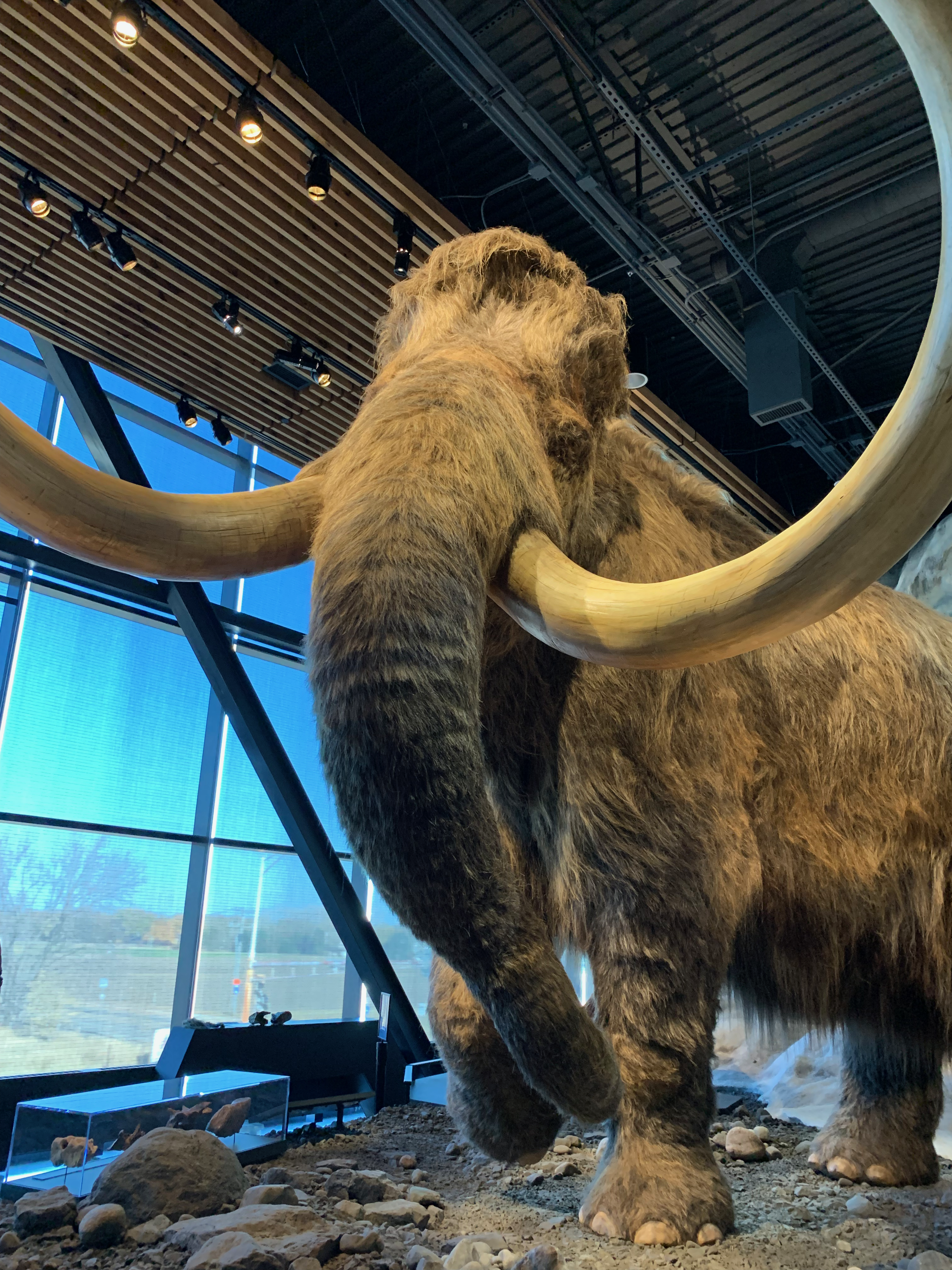
I learned early on in the Boy Scouts that what you pack you have to carry, no matter how far that hike will end up being. Because of this, I’ve learned to travel light. My biggest suggestion here is figure out how many clothes and shoes you really need to bring on a given trip. In my own case I’ll usually have the total number of travel days + 1 of underclothes, with a couple shirts, trousers, and sweaters that I can rotate through over a 3 or 4 day trip, and one pair of shoes which I’ve found are better carried in a tote bag separate from the backpack where everything else is, that way when I arrive my clothes don’t smell like my gym shoes. If necessary, as in this conference trip or the family funeral I flew home for last month, I’ll usually wear the suit I intend to wear for the big event (my panel or the ceremony) on the plane, that way it’s not getting wrinkled in my bag. On this trip to the Twin Cities, I did bring a winter coat, folded compactly into my bag alongside all my other clothes and toiletries in that bag. It turned out to be useful to bring that coat, even though it wasn’t ever really cold while I was on the ground in Minnesota (a rare thing), as I was able to put on that coat instead of the suit jacket on several occasions when I wanted to go explore the area, as in my afternoon visit to the Bell Museum’s dioramas across the river from Downtown Minneapolis.

A mammoth at the Bell Museum

The same logic applies to any souvenirs I might want to bring back with me. Anything I buy on the ground has to return in my bag that was already fairly full upon arrival. With this in mind the only new things I returned with were a stack of receipts for funding purposes, some notes from my panel, the conference program, and a printed version of the script for my presentation. I didn’t buy any souvenirs this time around at any of the museums, nor any other knick-knacks while I was there. Again, anything I have with me upon leaving has to either be left behind or carried in my bag for the entire return trip.

That return trip ended up being 15.5 hours long. I was traveling with my good friend Marco Ali’ Spadaccini from the History Department here at Binghamton, and we initially were set to wake up on our return travel day, Halloween, at 3:30 am Central to catch our 7:00 am flight. The first catch appeared when our first flight from MSP to Chicago-Midway was cancelled without any notice as to why. So, at 3:30 am we discovered we were instead leaving Minnesota on an 8:55 am flight to St. Louis. I wasn’t able to go back to sleep, thus starting my own travel clock then at 3:30 am. After getting an Uber to MSP Airport we caught our first flight on time and landed a few minutes early at St. Louis’s busy Lambert Field, where we had a quick hour connection to our flight to LaGuardia. That plane also arrived in New York a few minutes early, which meant in the end after our 3.5 hour drive from LaGuardia back to Binghamton through the Catskills, I returned to my apartment at 7:00 pm instead of 7:30 or 8:00 pm like I had predicted.

At this point I’m used to long travel days, it’s become more of a common thing for me in recent years coming to Binghamton, but even returning to Kansas City can be a taxing experience with the frequent need for connections going into an airport that as of now doesn’t host an airline hub. On this trip Marco and I considered traveling to Minneapolis by train and by car, both would’ve taken longer than flying, though Apple Maps’ estimated drive time was only 90 minutes longer than what it actually took us to fly between MSP and LaGuardia and then drive from Queens up to Binghamton. By train the trip would’ve taken us 30 hours with one connection between the Lake Shore Limited and the Empire Builder in Chicago, but the real kicker to that idea was the $3,000 price tag for two sleeper tickets roundtrip. Flying became the most economical option, and in the end, it was better that I was only fully focused on driving for a good 4 hours getting to LaGuardia rather than a full 17 hours trying to drive the entire route to the conference hotel in Minneapolis.

This was my last fly-away trip from Binghamton, the last in a long line of such trips that I’ve taken since arriving here in August 2019. I think back to one of my first, the trip 3 years ago this weekend to the Sixteenth Century Society Conference in St. Louis, when on the return journey I had a 4 hour connection at O’Hare. That day was the first time that I really felt like a business traveler rather than a guy off on another adventure. It’s a feeling I got throughout this trip too.

Signs

Yesterday evening, my parents and I drove out into my old high school stomping grounds in Lenexa and Overland Park, in the southwestern suburbs of Kansas City. My Dad had to return a truck part to a shop he frequents in Lenexa, and seeing as we were out there around dinner time, we decided to stick around and go to a restaurant in that part of town. It still feels strange sitting down inside restaurants again after a year of staying away. But it’s comforting to return to something that was so normal before COVID now as the crisis seems to at last be receding here in Kansas City.

What struck me the most about the experience of yesterday’s errands in Johnson County was actually getting an opportunity to just sit back and watch as people went to and fro around us. After all, this was one rare occasion when I wasn’t driving, instead taking my old childhood spot in the back seat of my Mom’s car, which gave me a great vantage point to just look around as we were driving on I-435 and along the streets and avenues. Seeing the myriad of vehicles all moving at different yet interdependent speeds seemed almost elegant to me, like a ballet of sorts. Yet I was especially struck in that moment by getting a chance to really stop and look at the highway signs themselves not for the sake of navigation or anything else particularly utilitarian, but just out of curiosity.

Here in the US, we have a couple different types of highways. At the top are the federal interstate highways, our controlled-access thoroughfares, essentially the same as motorways in Britain, Autoroutes in Francophone Europe and the parts of Québec I’ve been to, or the Autobahn in Germany. To date, I will say the best highways I’ve ever been on as a passenger was the highway between Helsinki and Turku in Finland. Below the interstates are the older US highways, federally designated roads that predate the creation of the interstate highways in the 1950s. I always found it fun growing up that my elementary school and parish church, St. Pat’s in Kansas City, KS was on US-24, the same highway that the road up to the top of Pikes Peak begins at. Below the US highways are state highways. In some cases, like with NY-17, these can be freeways like interstate highways. In others, like with much of NY-7, they tend to be official designations of older roads that predate the auto industry.

Because state highways are designated by each individual state, that means that their signage gets to be much more distinct than the federal highways. There is a standard look for state highways if the state government can’t come up with something themselves, basically a white oval or circle with the highway number in the middle, but most states choose interesting alternatives. New York’s for example are in a quasi-hexagonal shape, that I’m guessing was the original shape of their state highway signs in general. Colorado’s are done up in the colors of the state flag. And Kansas’s, which got me to write about this topic, put the highway number in the middle of a sunflower on a black field.

In my high school years, I used to drive twice a day, every day, up and down K-7 (Kansas Highway 7) between western Kansas City, KS and western Lenexa, KS where my alma mater, St. James Academy, is located. At the time, I noticed the distinctive signage, but it never really meant much to me. Yesterday however, seeing it again and really looking at it, I realized how much I’d come to like it. There’s something about that Kansas sunflower highway sign that feels as homely to me as California’s rounded sign seems a bit exotic. Seeing the sunflower again yesterday brought a smile to my face, thinking about how much I’ve come to like it.

While I’m on the topic of state highways, I do want to make one big suggestion. The way in which we refer to our different highways in this country is really inconsistent. I’m often confused when I’m in the Northeast, not being a local, trying to figure out what people are referring to when it comes to highway names. For me, having grown up in Kansas, state highways are “[State Name] [Highway Number]”, so K-7 (Kansas 7) or NY-17 (New York 17). US Highways in turn are US-X, so US-71 or US-11, and interstates are I-X, so I-70 or I-35. In some cases, like in my original hometown of Chicagoland, highways are actually named, and there I’d rather use the names. I may write another post about that in future, so in those cases while the highway may be I-55, I’ve always just called it the Stevenson.

All that said, when I moved to New York, I was constantly confused when locals would offer me directions in large part because every highway was just called “Route X,” so Interstate 81 is Route 81, US 11 is Route 11, and New York 26 is Route 26. There are other examples, around Binghamton NY-17 is still being upgraded to interstate standards, resigned as I-86, so whereas I call it I-86, most locals I’ve talked to still call it Route 17. Despite the NY plates on my car, it’s one way that I think I still stand out not being a New Yorker.

Time Zones

I’ve always been fascinated by how we understand the passage of time, from the older ideas of local solar time, to the nineteenth century adoption of standardized regional time zones, to now how most people I know seem to have at least one aspect of their life guided by the reality that they have to work with multiple time zones in a given day. Take my case: I work at a university located in New York, which is in North America’s Eastern Time Zone, but at the moment I’m staying with my parents in Kansas City, a city located in the Central Time Zone. This means that I have to keep an eye on the clock with a mind not only for the local time where I am, but the time as it is one hour ahead of me in New York.

As any Midwesterner from west of most of Indiana will tell you, any national TV or radio broadcast will always be announced in Eastern Time and Pacific Time, meaning that those of us in the Central Time Zone just have to subtract an hour from the listed broadcast time in the East to get our own broadcast time. And our friends out in the Mountain West just have to look at the Pacific broadcast time and add an hour to get their’s. What this means is that the listed broadcast times on any TV or radio show in the Continental United States relies on 35.8% of the population rarely ever sees national broadcasts listed in their own local time. Granted, the largest population centers in the country are on the coasts, but coming from the middle of the country, this has always been a bit of a sticking point for me.

Driving across the US, you’ll often come across the usual Welcome signs when entering new states, new counties, or new cities. In some places, particularly in the Rockies, each city’s welcome sign will include that city’s elevation where in the prairies it might include the population or the date that settlement was founded. Meanwhile, each state has its own at times unique welcome sign. I always enjoy seeing those, because it marks a real milestone on each of my long drives. My favorite welcome sign to date remains Colorado’s, though normally where I see it on I-70 at the Kansas/Colorado border the dominant colors in colorful Colorado are the golden brown of the Great Plains stretching off to an endless blue, though sometimes gray, sky.

Photo by the author. 26 July 2013.

Yet alongside all these welcome signs, and the signs advertising this country’s wonderful and often weird roadside tourist attractions, are the occasional signs you’ll pass by that announce that you’ve entered a new time zone. It baffles me that neither the Illinois nor the Indiana Departments of Transportation have put such signs on I-70 on their shared border just west of Terre Haute, where I usually will gain or lose an hour depending on the direction I’m driving between Binghamton and Kansas City. Still, these signs are always an even bigger marker of progress on a trip, a sign (pun intended) that you’ve moved not from one of the 50 states to another, but from one of the 6 continental North American time zones to another.1 It’s a rarer thing to do.

There is one thing about how this country is divided by time zone that does bug me, and that’s the eastern edge of my own native time zone in Indiana and up the middle of Lake Michigan. You see, back in the nineteenth century when these time zones were first being set up, the merchants and city leaders in Detroit wanted to be on the same time zone as the markets in New York and Toronto, so they got Michigan as a whole to be put in Eastern Time. Later, in the twentieth century, Indiana’s state government decided the majority of their state should also be on Eastern Time, probably because of Michigan’s decision, leaving the option of being on Central Time up to only the westernmost Hoosier counties. As a result, cities like Gary in Northwestern Indiana that are a part of Chicagoland are in Central Time, while the rest of the state is an hour ahead.

But geographically, that border between Eastern and Central Time should be further to the east. Geographically, Indiana and Michigan should be on Central Time, not Eastern. This would allow both states to be on the same time as the Midwest’s biggest markets in Chicago, while at the same time causing some problems for Detroiters driving across the border to Windsor, Ontario, or people commuting into Toledo, Ohio from Michigan. All that said, I do use the time change on the Illinois/Indiana border to my benefit when I’m driving in either direction across it. Going east, if I leave Kansas City at 07:00 CT, it means I can stop for dinner around 17:00 ET in Indianapolis, which if it were in Central Time would usually be an hour too far west (16:00 CT) for my usual dinner time. Going west, if I leave Binghamton at 07:00 ET, I can use the extra hour to get a little further along the drive, even making it as far as St. Louis, which is only 3.5 hours from Kansas City before 22:00 CT (23:00 ET).

Then there’s the issue of the seasonal time changes. In North America we call it Daylight Savings Time, while in Europe it’s called Summer Time. This means that over here the official time zone abbreviations change from CST in the cold months to CDT in the warm ones, while the UK’s time zone remains BST (British Standard Time/British Summer Time) all year round. I personally tend to agree with the people calling for us to just adopt Daylight Savings, i.e. Summer, Time all year round. It makes more sense, and even though it can be a pain to get up before dawn in the mornings in the Winter, that’s just a part of Winter. I always thought it was kinda neat, though I admit I never really have been a morning person, so my appreciation for any wake-ups before 08:00 are limited at best.

That said, even if one US state here in the Midwest or in the East did vote to switch permanently to Daylight Savings Time, as Missouri is currently considering, it would require every other state in that region to do so as well. Unlike Arizona, the most notable state to make this change, there are too many cities in the Midwest that are close, or cross to state borders. Some notable ones among these are Chicago, St. Louis, Kansas City, Cincinnati, Louisville2 Milwaukee, the Twin Cities, Omaha, the Quad Cities, Duluth-Superior, and Detroit.

Even today, the furthest eastern reach of Chicago’s suburban train network extends from the Central into the Eastern Time Zone with the South Shore Line in South Bend and Hudson Lake, Indiana. Imagine if Missouri’s bill was signed into law without the provision that Kansas agreeing to it as well. Every time someone crossed State Line Road here in Kansas City between the first Sunday in November and the second Sunday in March, they’d have to adjust their clocks by an hour. Because of this, if one Midwestern state decides to adopt Daylight Savings Time permanently, everyone else will have to follow along, or else it won’t work.

As you can see, just from the intricacies of it, I enjoy thinking about time zones. In a couple of months when I drive west from Kansas City on a vacation out to the Rockies, I’ll look forward to seeing that rare sign on I-70 in Western Kansas announcing my entry into Mountain Time. I know, it’s nerdy, but it’s something I enjoy thinking about.


Notes

1 The six continental North American time zones are: Atlantic, Eastern, Central, Mountain, Pacific, and Alaskan. You could also include Hawaiian-Aleutian because part of it does reach sections of the Alaskan mainland (I think), but that seems a bit of a stretch.

2 Yeah, Louisville is in Kentucky, but it’s borderline Midwestern.